Australians have a rich, rewarding, and fun relationship with the humble bicycle, spanning more than a century. From the historic ‘overlanders’ – those bike-borne explorers and adventurers who crossed and circumnavigated this vast land of ours in the late 19th and early 20th centuries – to our strong competitive international cycling heritage on the road and on the trails, through to families who simply enjoy bike rides together in the outdoors, we are a proud bike-riding nation.
For more than 35 years Australian Geographic has been encouraging its audience to get outdoors, explore and connect with this wonderful country of ours and there are few more fun ways in which to do so than to jump on a bicycle and start pedalling. It is this ideal that led Australian Geographic to produce “Australia’s Best 100 Bike Rides”, a guidebook that details some of this country’s greatest bicycle rides, for all age groups and skill levels (available from all good book stores and online here). In this exclusive excerpt from the book, we reveal our three favourites from each state and territory.
NEW SOUTH WALES
Perimeter-Long Trail
Distance: 21km Grade: Easy Bike: MTB/Gravel
This magical there-and-back-again ride is found at Terrey Hills, in Sydney’s Northern Beaches area. This ride combines two designated routes – Perimeter and Long trails, in Ku-ring-gai Chase National Park – to deposit riders at one of Sydney’s most beautiful viewpoints: Peach Trees Lookout. From this high-up natural wonder, there are expansive views across the Hawkesbury River to Cowan Creek and Berowra on the northern banks of the river. Reaching Peach Trees is a lovely ride along primarily firetrail (Perimeter Trail is signposted and there is ample parking on streets near its start point), through dense bush dotted with eucalypts, grass trees and loads of wildlife.
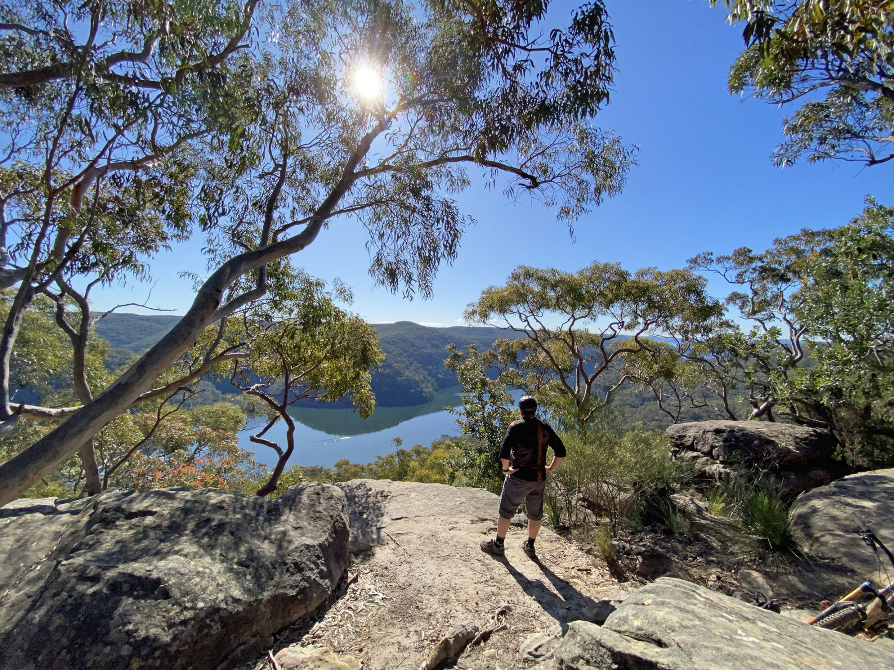
The Perimeter Trail comprises the first section and is a wide, undulating firetrail (keep an eye out for horse riders and walkers here) that loops north and west around the top end of Terrey Hills for a touch over 6km before you reach the Long Trail turn-off that takes you north. From here, the route is slightly rougher under your wheels and continues its undulating profile for just under 4km before you reach the lookout. You cannot ride up to the rock that offers the best views but can leave your bike just below and walk. The ride is ideal for families, and it is well worth taking a picnic and to spend some time admiring the view (and refuelling) before the return journey.
Central West Cycle Trail
Distance: 400km Grade: Intermediate Bike: Gravel/MTB
Through wheat-lands and woodlands, this new arrival on the cycling scene loops through NSW’s Central West region, following backroads on a tour that can be stretched across a week. Opened in 2020, the route puts towns in easy reach each night – Mudgee, Gulgong, Dunedoo, Mendooran, Ballimore, Dubbo, Wellington, Goolma – with the spaces between no longer than 60km.
The ride is that rarest of things in Australia – a road route specifically targeted at cycle tourers. The loop ride is a mix of sealed and unsealed roads, and it provides a gentle introduction to touring – you’ll need to carry panniers or bikepacking bags, but you can get away without camping gear or much food on board.
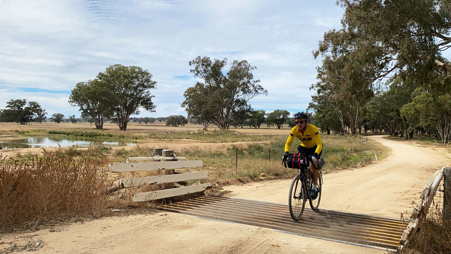
To this, it adds wine country around Mudgee, pockets of gold-mining history, and beautiful rural country interspersed with forest and dotted with wildflowers. In a couple of places, there’s a choice of two routes – roads suitable to gravel bikes, or more challenging stretches for mountain bikes.
The CWC can be started anywhere around the loop, and cycled in either direction, but Mudgee makes a good starting point, pedalling out through its surrounding vineyards, which make a good excuse for a short day (30km) to Gulgong, a town rich in gold-rush history.
The classic country moments continue with the likes of the grand red-brick Hotel Dunedoo, the silo art in Dunedoo, and the hospitality that has farmhouses, such as Mayfield (near Birriwa), and even the post office in Wongarbon, preparing morning tea for cyclists who call ahead. There are also hatted restaurants and a whisky and rum distillery in Mendooran.
Narooma-Dalmeny Coast Ride
Narooma-Dalmeny Coast Ride
Distance: 21km return Grade: Easy Bike: Any
The NSW Far South Coast towns of Dalmeny and Narooma abut a coastline that is magnificent in its splendour, with golden beaches, inlets and, just off the coast, Barunguba (Montague Island). Thankfully, for two-wheeled visitors, there’s a brilliant bike path that links the two towns, allowing you to experience all these natural wonders up close.

The ride heads north from Narooma with the start at Riverside Drive, near the wharf at Wagonga Inlet. From here you follow the path beside the blue-green waters of Wagonga Inlet, toward Narooma Highway Bridge. After crossing the bridge, you join the (timber) Mill Bay Boardwalk and wind around toward the inlet’s mouth (stop at where fisher-folk clean their catch and you may spot one of the resident seals). As well as seals, keep an eye out for other marine life, such as rays, and fish, and – if you’re riding here in whale season – there’s a high chance of spotting these migrating giants, too. Continuing, you ride past wetlands (great for birdwatching) and then any number of beaches. The ride is excellent when it comes to outlooks; several viewing platforms along Kianga headland offer views over some of the best beaches in NSW (there are also picnic spots along this route). The sealed path continues all the way to Dalmeny Sports Club, your start/turn-around point for this memorable family ride.
AUSTRALIAN CAPITAL TERRITORY
Lake Burley Griffin
Distance: 35km Grade: Easy Bike: Any
When Walter Burley Griffin designed a lake at the heart of Canberra, he could easily have had cyclists in mind. Its shores are flat, its 35km circumference makes for a perfect few hours of pedalling and almost every national public building of note sits huddled along its edges. The lake is entirely ringed by a shared-use path, which clings to the shores of the lake most of the way. The major deviations from its shores take you around Government House in Yarralumla, and through the Jerrabomberra Wetlands at the lake’s eastern end.
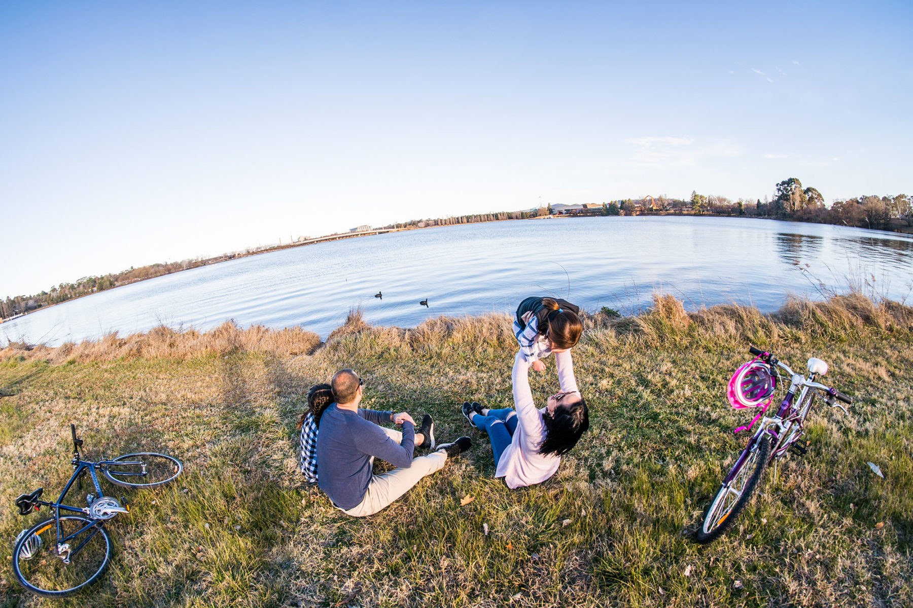
Doubling as a sightseeing tour of the national capital, the ride can be started anywhere along the lakeshore, and be cycled in either direction. Navigation is simplicity itself – simply keep to the mostly sealed path beside the water. Highlights include the Parliamentary Zone, where riders pass the National Gallery, the flag-festooned High Court, and the monolithic National Library, with Parliament House set on a low hill behind. The foreshore precinct in Kingston – where the path returns to the lake after arcing out through the wetlands – and the avant-garde New Acton district offer more distractions.
The ride is pretty much a choose-your-own adventure. You can lap the lake in a two-hour burst, or linger in the National Arboretum, National Museum, or any of dozens of other lakeside diversions to draw the ride out across a full day. If you’re an early riser, it’s a beautiful dawn ride, when the rowers are on the waters, the hot-air balloons are in the sky, and the day and the lake are likely as still as a meditation.
Stromlo Forest Park
Distance: 50km+ Grade: Easy to Advanced Bike: MTB
Welcome to MTB heaven. Stromlo Forest Park is just 15 minutes from downtown Canberra and has just about every type of riding for anyone who enjoys dirt under their knobbies. All-up there is said to be more than 50km worth of trails here, if you include the trials skill park, four-cross track, pump track and even a criterium circuit for road cyclists. There’s also a café, showers, toilets, plenty of parking in several different locations and even shuttle buses for those not keen on the climbing.
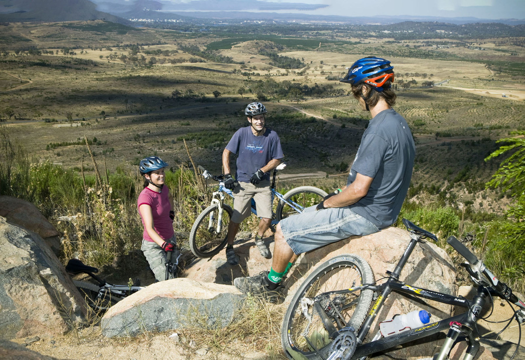
Sitting on the slopes of Mount Stromlo, the park was developed in the wake of devastating 2003 bushfires that destroyed the old informal riding network. The trails at Stromlo cater for cross-country and downhill riders and vary in difficulty from beginner to expert – or white to double black using the International Mountain Biking Association’s grading system.
The geography is rocky in places and the hill is quite exposed, which makes it a dusty and sweaty place to be in the heat of mid-summer Canberra. Best to ride early or late on those sorts of days. In winter it can get pretty darn cold but there’s not too much rain, so great MTB weather!
On the comprehensive website you’ll find six downloadable maps of loops for riders having their first pedal, all the way to the gnarliest of hardened veterans. As a general guide, the closer to the café you are, the gentler the riding. Those with confidence and fitness can strike out for the northern trails in the farthest reaches of the park. They require skill and climbing legs but the rewards of trails like the rocky Pork Barrel and beautifully crafted Double Dissolution make it all worthwhile.
Canberra Centenary Trail
Don’t be fooled – this long weekend circumnavigation of our capital city is no pushover of cycle paths and coffee stops. Sure, those things crop up now and again, but you’ll also need some serious grunt to tackle the series of big hills that encircle Canberra. The city and surrounds are renowned as a mountain biker’s paradise for a reason! Officially starting and ending at Parliament House (but possible to join at any point), the trail heads north up to the NSW border, before cutting west through some flowy rural country and cruising the longest, sweetest downhill of them all to the cute village of Hall. From there it continues south past the MTB mecca of Stromlo and the end of Lake Burley Griffin, taking in the standout section along Red Rock Gorge and into Tuggeranong, where it swings north again and back into the city.
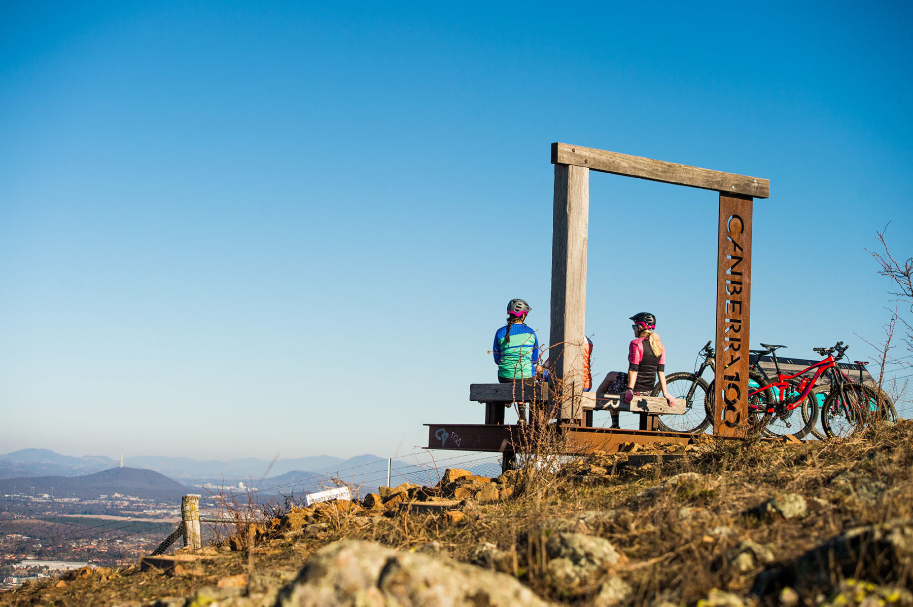
The riding is a mixture of urban tarmac, rustic grass/dirt, and mountain bike singletrack. Campsites are thin on the ground in Canberra, so take advantage of the proximity to civilisation and make a holiday of it by booking a few nice hotels (with showers!). The CCT doubles as a walker’s trail, so watch those tight corners, and allow plenty of time for picnics and sightseeing. Hell, if you stop at every attraction you pass, from the War Memorial to the Dinosaur Museum, you could be at it for weeks!
VICTORIA
East Gippsland Rail Trail
Distance: 97km Grade: Easy Bike: Gravel/MTB
Gippsland is the patriarch of rail trails in Australia, with almost a dozen of these converted railways zipping across the lush region. Prime among them is this ride between Bairnsdale and Orbost, following a century-old railway line through the forests and farmland that define this eastern end of Victoria. The railway remains a true presence along the ride, with a number of historic trestle bridges keeping the trail company.
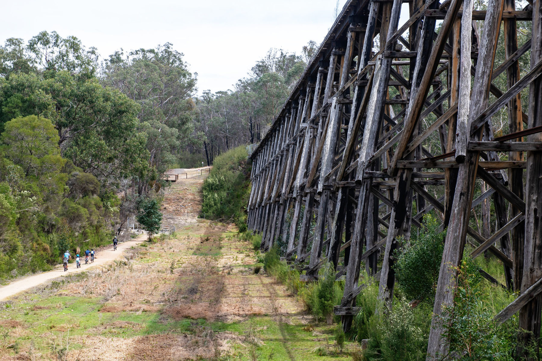
From Howitt Park, on the bank of the Mitchell River at Bairnsdale’s edge, the trail (colloquially known as the Easy Gippy Rail Trail) sets out across the floodplain, running sealed to Nicholson (and unsealed for the rest of the trail beyond), with occasional views south to the Gippsland Lakes. Leaving Nicholson across the old railway bridge over the Nicholson River, the ride takes a sudden turn north, heading into Bruthen. Thirty kilometres from Bairnsdale, Bruthen makes the perfect lunch stop.
Another railway bridge leads over the Tambo River, where the trail begins climbing towards its highest point (129m above sea level) at Colquhoun. Just before reaching the apex, there’s a junction with the Gippsland Lakes Discovery Trail, a secondary rail trail that detours 25km south into Lakes Entrance – if you want to add the lakes to the Gippsland cycling experience, head away here.
The descent from Colquhoun bottoms out at Stony Creek, beside the trail’s signature feature – the 276m-long, 19m-high Stony Creek Trestle Bridge. With its 27 spans, it’s the longest bridge of its type to be found in Victoria. There are more trestle bridges ahead, including the curved O’Grady’s Bridge at Wairewa (which was badly burned in bushfires in 2020).
Main Yarra Trail
Distance: 22km Grade: Easy Bike: Any
Here’s proof you don’t need to pack your bike up and travel hours into the countryside to get in some off-road riding. Melbourne’s Main Yarra Trail starts – or finishes depending on your perspective – at Southbank in the CBD and meanders alongside the river it is named after, through the Victorian capital’s north-eastern suburbs.
The other end of the trail is widely judged to be Westerfolds Park in Eltham, partially because it is a logical place to park a car. But it is possible to ride further east toward Warrandyte. The surface can vary from gravel singletrack to concrete walkway and the level of traffic on foot and two wheels can reflect the fact it navigates through the heart of one of our greatest cities.
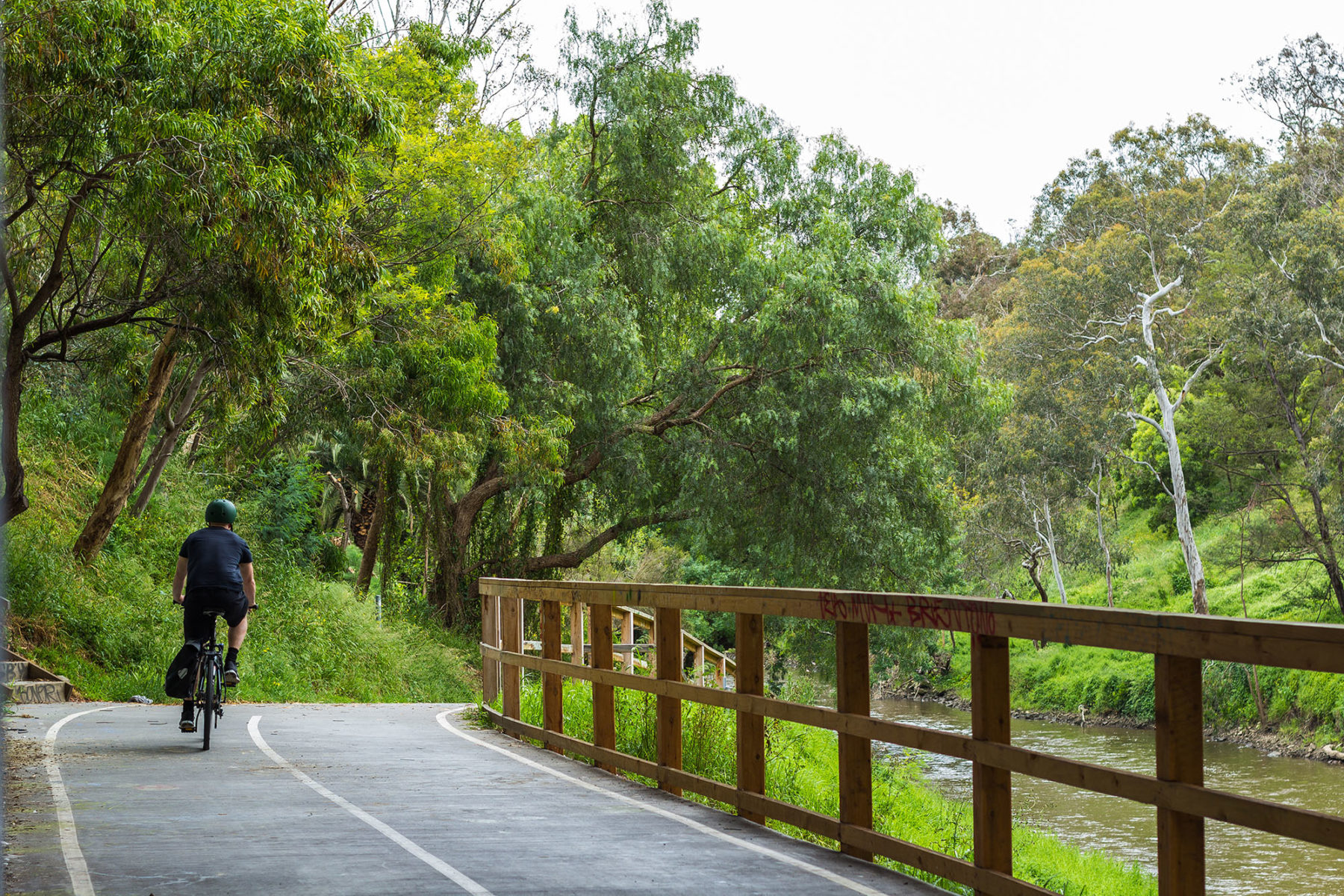
Despite its urban location it is certainly possible to feel you’re far from the maddening crowd on the Yarra Trail. On an isolated section I once disturbed a large snake that then surfed away over the surrounding bushes to escape me – not that I wanted to chase it! There is another section where you meander through trees on singletrack immediately below the Eastern Freeway. For all that, the good news is being so close to civilisation means coffee and a feed is never far away!
The Cruffin Run
Distance: 53km Grade: Intermediate Bike: Gravel
In the same way that gravel bikes combine road and mountain bikes, cruffins are the result of merging croissants, donuts, and muffins. The outcome is the delectable, jam- or curd-filled sugary pastry that you’ve been missing from the start, middle or end of every bike ride you’ve ever done, except this one.
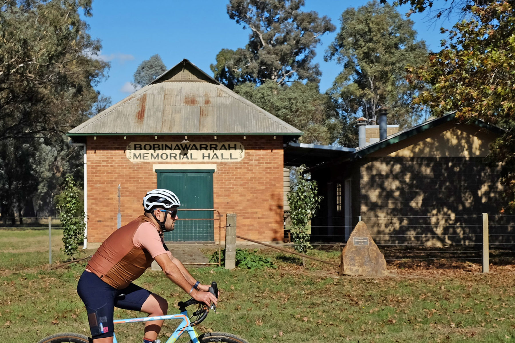
Start in the village of Moyhu in the King Valley, just 20km from Wangaratta in Victoria’s High Country. There’s a gravel loop trailhead here, plus toilets, a cafe, and a pub. After your pre-ride coffee (naturally), head east on a quiet sealed road for 5km before turning north. The transition to shady, gumtree-lined backroads and farm lanes is almost instant, and the flat gradient means you’ll spend far more time looking at the beauty around you than focusing on which gear you’re in.
It’d be rude to ride past the famous Brown Brothers cellar door at 22km without stopping in, so once you’ve scratched that itch, press on for another couple of kilometres through the Milawa township. Assuming you’re there early enough for there to be any remaining, your cruffins are waiting for you at The Milawa Kitchen, next to the Milawa Cheese Company.
There’s enough on offer here for you to spend a good hour or two taking it all in. In fact, a set of panniers or a backpack might come in handy, particularly as on the return journey to Moyhu you’ll pass a mustards shop, a smokehouse, two providores, another bakery, more cellar doors, and a gin distillery. Luckily the return 25km to Moyhu is just as flat and scenic as the first half of the ride, so you probably won’t even notice the extra kilograms you’ll be carrying back to the car…
TASMANIA
Clarence Foreshore Trail
Distance: 14.5km Grade: Easy Bike: Any
This trail follows Hobart’s picturesque Derwent River, kicking off at Geilston Bay and finishing at Howrah. Consisting of mostly flat footpaths, with the odd gravel section, a few roadside connections and a couple of hills, the trail is accessible for all abilities and skill levels, with plenty of entry and exit points. A highlight for families? Playgrounds galore for those inevitable refuel and rest stops. For those riders with little legs, a shorter version sees you set off from Geilston Bay and finish at Bellerive Park, with its playground and – yes! – the chance to indulge in fish and chips by the beach.
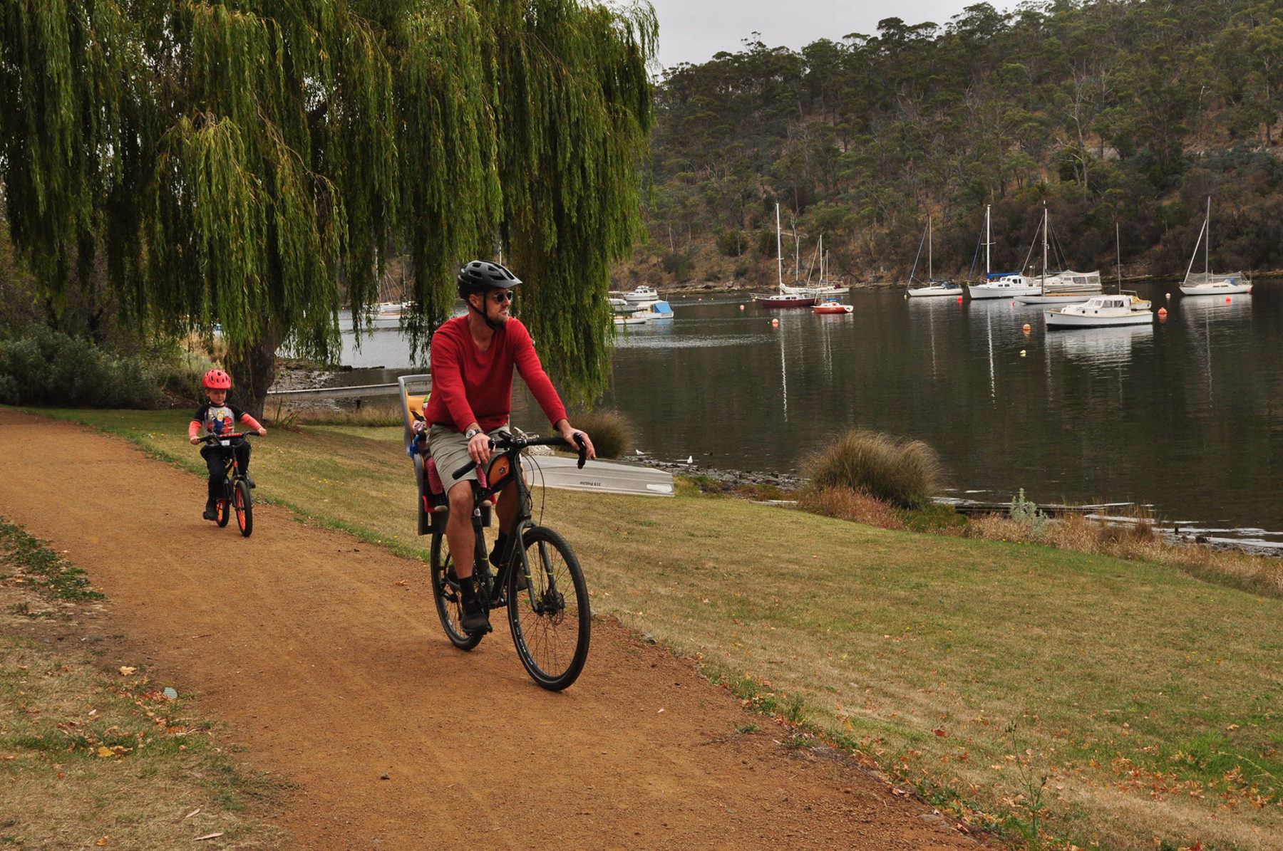
The ride encompasses magical views, from yachts bobbing on their moorings, to willow trees dangling over the trail. Passing under Hobart’s famous Tasman Bridge is a highlight, especially for the youngest cyclists, with the chance to test the echoes bouncing off the huge concrete pylons.
At Kangaroo Bay, about 9km from the start, you may time it right for local market stalls. The beach here is beautiful, plus those aforementioned fish and chips are available nearby. The final leg around a headland leads Bellerive Beach and then on to Howrah Beach.
Blue Derby
Distance: 125km+ Grade: Easy to Advanced Bike: MTB
Since launching its network of mountain bike trails in 2015, the once-forlorn tin-mining town of Derby has become a byword for mountain biking. Its network of trails, which now extends to around 125km, instantly generated such fanfare and attention that it almost single-handedly inspired the burst of trail openings across Australia in the subsequent years.
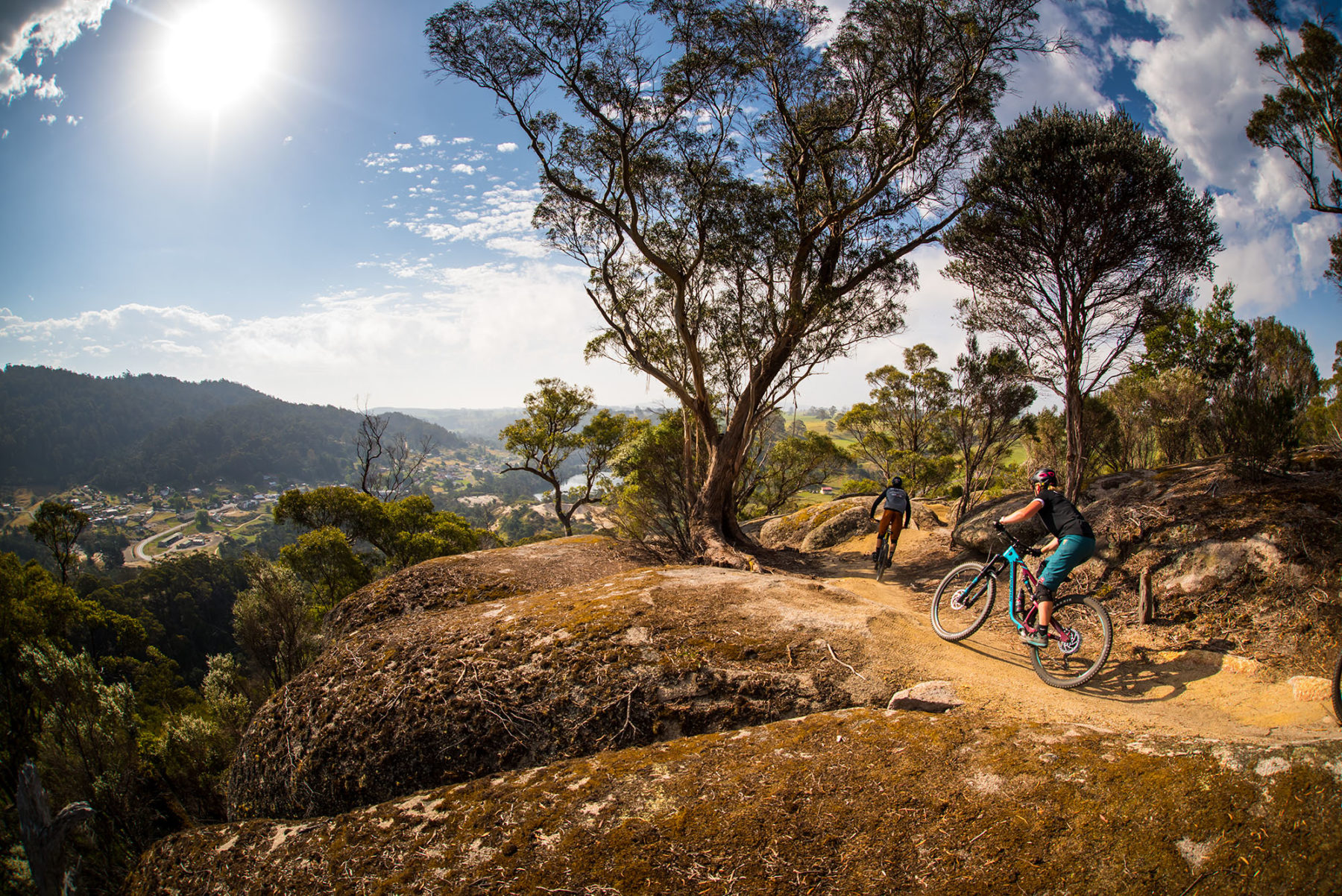
The key to Derby’s appeal is the flowing nature of its trails, which begin high in the Blue Tier mountains, with a compact cluster of trails around Derby itself. A large pump track on the bank of the Ringarooma River keeps crowds of kids happy, while the riding can begin as leisurely as a lap around Lake Derby, across the river from town.
Signature trails include Blue Tier, which hurries down rainforest-covered slopes of its namesake mountain range to Welborough; and Atlas, which continues the journey from near Weldborough down into Derby. Shuttle services out of Derby make it possible to ride both in a full, 30km day, descending from sub-alpine clearings at the top of the Blue Tier through magnificent rainforest to the dry sclerophyll forests around Derby.
Shuttles also head to the Black Stump, dropping riders off at fun descents such as Flickity Sticks, Return to Sender, Kingswall and Kumma-Gutza. Shuttles aren’t always necessary, with the gentle Axehead looping out from town to connect with a host of other trails. Favourite trails at the black end of things include Detonate, where bike handlebars all but scrape between boulders; and the steep and technical Trouty, which compensates with fine views… if you can find an opportunity to look up.
Montezuma Falls
Distance: 11km return Grade: Easy Bike: Gravel/MTB
It’s a blessing to cyclists that a mining tramway once punched its way through the damp rainforest of Tasmania’s west coast to the base of the state’s highest waterfall. The North East Dundas Tramway was once used to transport ore to smelters in Zeehan, but is now shared by mountain bikers and walkers wanting to view 104m-high Montezuma Falls.
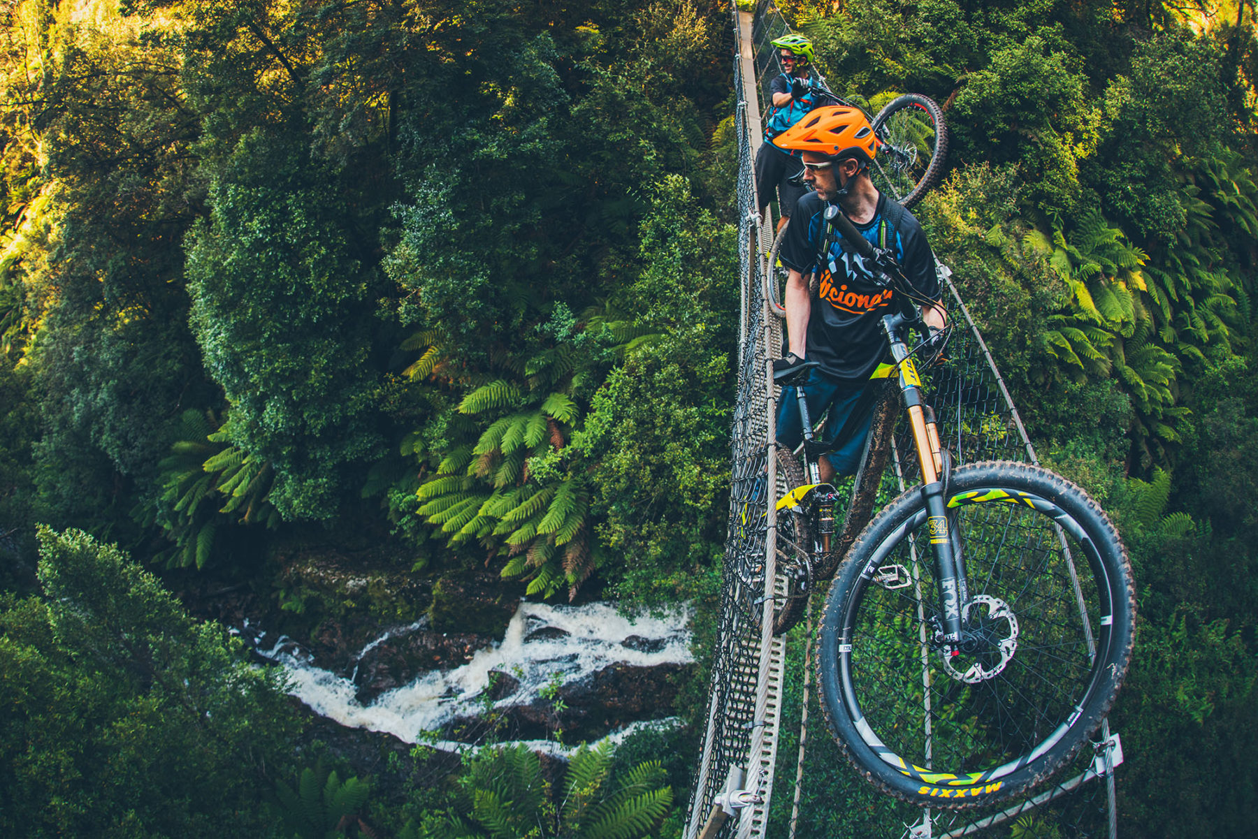
There are two cycling approaches into the falls. The longer and more difficult ride is a 14km (one way) route from Melba Flats, but the simpler approach (described here) is along the old tramway beside the Ring River. Rainforest is the one constant of this often-muddy ride, which sets out from Williamsford and dips to cross Baker Creek before joining the course of the tramway. The greatest relic of the tramway days is an original wooden bridge immediately beside the trail’s newer bridge almost 2km into the ride. Further ahead, there’s a section of old tramway sleepers ribbed across the track – a bumpy ride guaranteed – and an old mining shaft that disappears into cliffs just before you reach the falls.
The track ends a few metres before the waterfall, which was named after Montezuma Silver Mining Company and spills down the cliffs in a narrow stream. You can wander to its base and out onto a heady swing bridge with fine views onto the waterfall. The bridge is also the start of the trail to Melba Flats if you want to ride a linear through-route – it’s a 19km ride in total but requires a vehicle shuttle from Melba Falls back to Williamsford.
NORTHERN TERRITORY
Uluru Circuit
Distance: 10.6km Grade: Easy Bike: Any
This full loop of the world’s most famous monolith is a must-do for any visitors to the Northern Territory’s Uluru-Kata Tjuta National Park. It is a very easy, very flat ride that you could, if you were, for some odd reason, in a rush, complete in less than an hour, but please don’t. ‘The Rock’ as Uluru is also known, hides some incredibly scenic and spiritual secrets that you must experience for yourself.
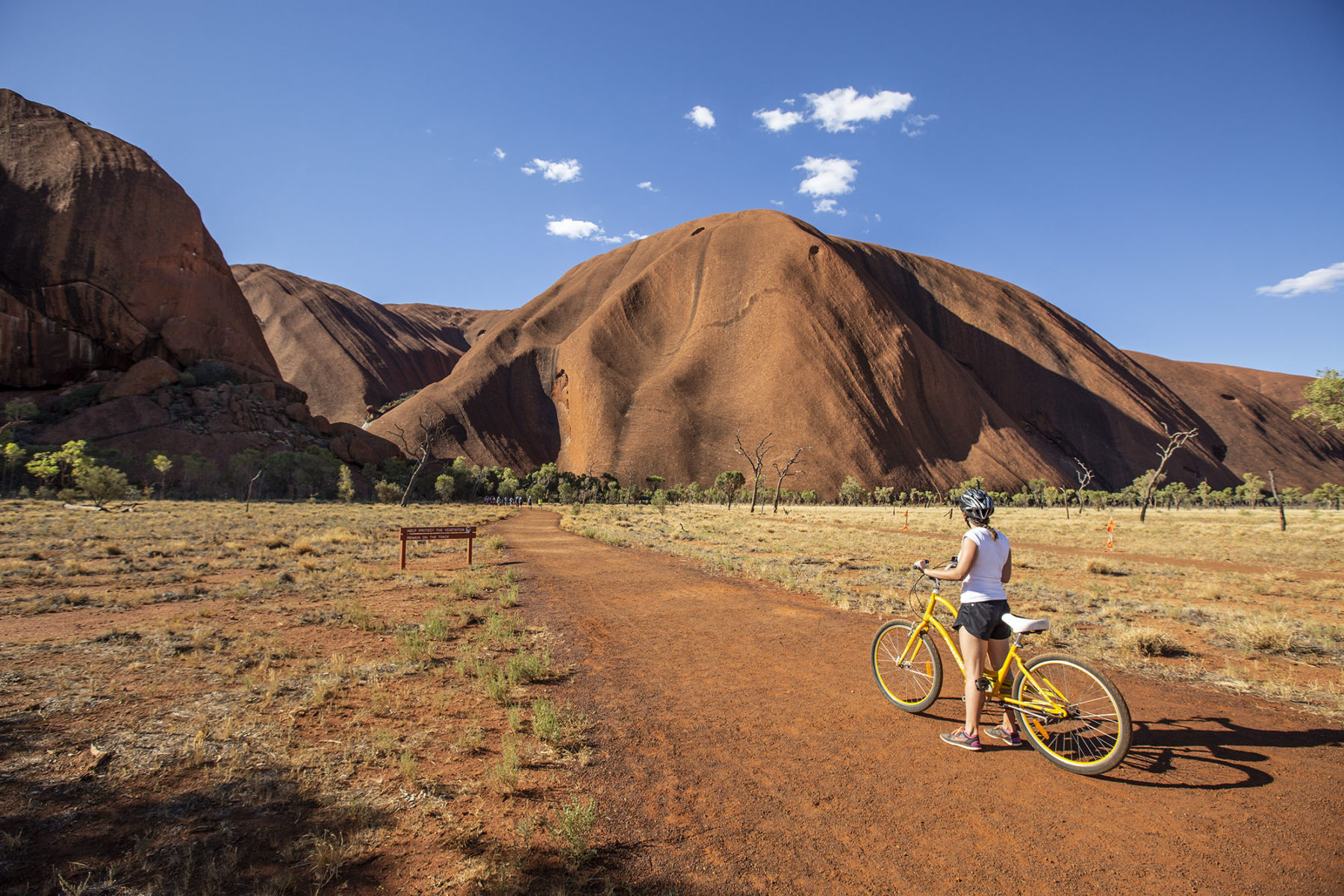
The ‘official’ loop starts from the Mala car park, but if you’re hiring a bike (Outback Cycling offers hires), you will start from 2km west, at the Uluru-Kata Tjuta Cultural Centre car park and take the bike path to Mala. From here, it is an anti-clockwise journey on predominantly hard dirt, with a little bit of sand to negotiate from Mala to Mutitjulu waterhole. This part of the loop brings you close to Uluru itself before a must-stop at Mutitjulu waterhole where you can park your bike at the bike rack and take the short walk into the gorge itself.
The track then continues around Uluru, moving further away from the rock, before you ride parallel to its more heavily eroded northern face. After that, though, you’re back closer and ready for more exploration at Kantju Gorge and its pretty waterhole. From there, the loop continues to curve around and, before you know it, you’re back at Mala and ride’s end, but far richer for the memories of experiencing this ageless icon up close.
Nitmiluk
Distance: 19km Grade: Easy to Intermediate Bike: MTB
Nitmiluk National Park has always been a highlight for visitors to the Northern Territory, with its spectacular gorge system previously only able to be admired from the water or on foot. With thirteen gorges to visit, most visitors never get past the first couple, but with the introduction of mountain bikes into the national park, it is now possible to ride to some stunning locations.

The climate here dictates the ride. The green Jalkwarak loop is under 6km and is a wise warm-up. Being close to the road and the ranger station, you can ensure that everything is in order before you push deeper into the park. The network is around 19km and is mainly shared use, although being up on the plateau you won’t see many other users on the network. The newly built MTB-specific sections of trail – Jalkwarak (Easy Grade) and Jatete (Intermediate) – are fantastic with Jatete offering brilliant views over the pristine Katherine River. The more adventurous can push further east on shared-use trails to Pat’s Lookout or descend Bamjon for a cooling dip.
If you want a ride and swim, the nearby town of Katherine has a town loop and lovely natural spa that’s easy to get to. Just remember crocodiles live at Nitmiluk. The harmless freshwater crocs are year-round inhabitants but the deadly salties slip in during the wet season, so only get in the water after the all-clear has been given by the park rangers. Crocodiles, stunning views, and remote trails, you won’t forget this day’s bike ride!
Simpsons Gap Bike Path
Distance: 17km Grade: Easy Bike: Hybrid/Gravel/MTB
Running umbilically between Alice Springs and Simpsons Gap, the nearest of the West MacDonnell Ranges’ multitude of narrow gorges to the city, this fully sealed bike path is a desert delight. Beginning beside the boulder-topped grave of John Flynn, founder of the Royal Flying Doctor Service, the path rolls gently through the Alice Valley, pinched between the rust-red mountains of the West MacDonnells and the Heavitree Range.
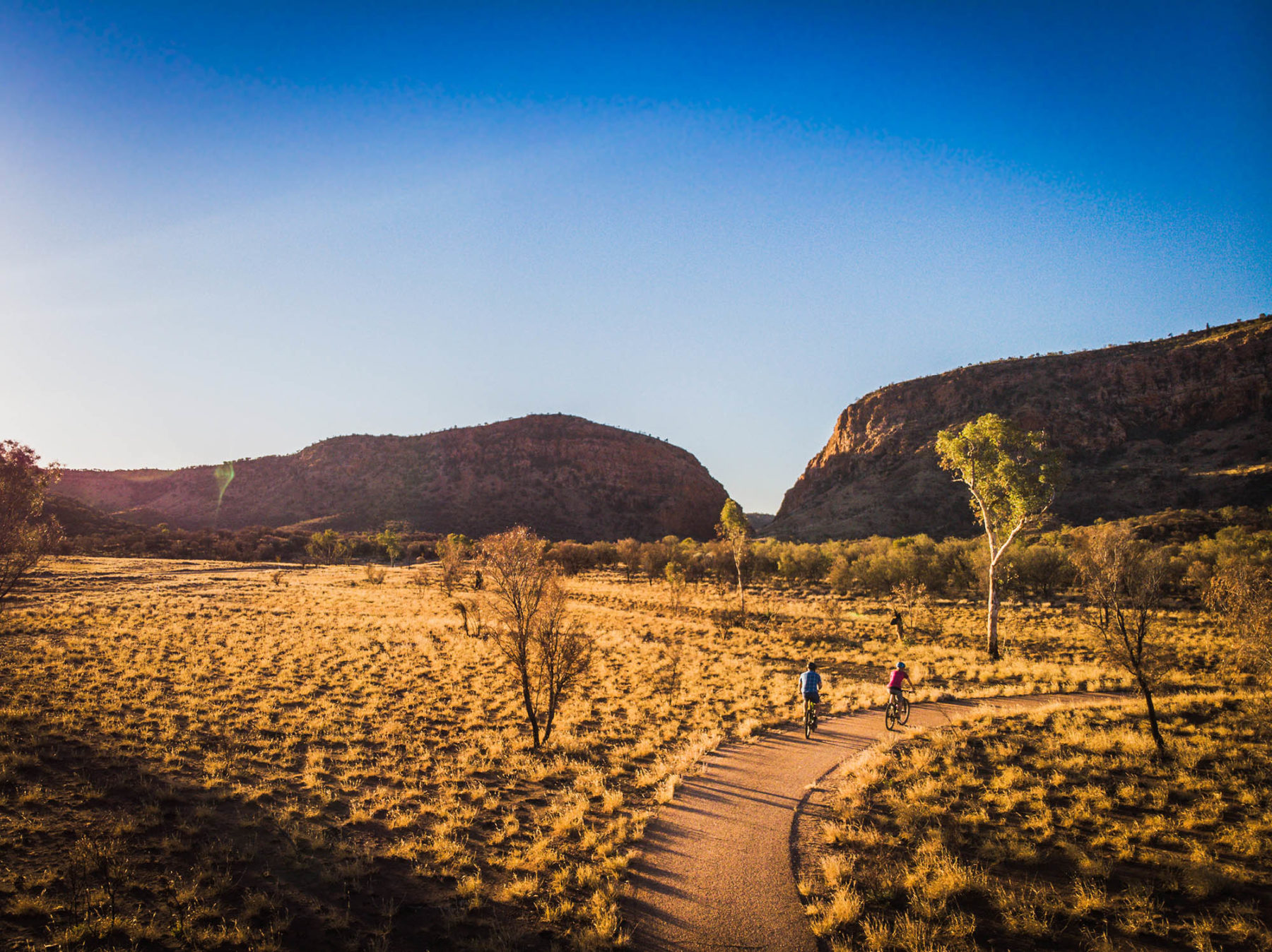
For all but the first kilometre, the ride is inside Tjorita/West MacDonnell National Park, winding between low hills but making few climbs of its own. The open landscape is brightened by ghost gums, desert bloodwoods and the lavender-like flowers of the mulla mulla. There are two picnic tables (with bike racks) tucked into the shade of ghost gums along the path, and a 1.8km walking trail to Cassia Hill (named for cassia shrubs that cover it) that starts from the path’s edge as it makes its final turn towards Simpsons Gap.
The last 700m of the ride is on a roadside bike lane (where it also crosses the Larapinta Trail), ending in the Simpsons Gap car park, from where it’s a 400m stroll along the sandy creek bed to the Gap. This break in the mountains creates a spectacular scene – in full sun, the orange cliffs seem to glow like coals above the permanent pool (swimming is banned) inside the gorge. Black-footed rock wallabies are commonly seen among the rocks that litter the slopes outside its mouth. With average summer temperatures reaching 36°C, this is a path best pedalled in the cooler winter months.
WESTERN AUSTRALIA
Rottnest Island
Distance: 4-22km Grade: Easy Bike: Any
Picture an island in the Indian Ocean fringed with 63 beaches, where the only motorised traffic is a bus, and an island-based rental company has almost 2000 bikes in its fleet. Welcome to the cycling beauty of Rottnest Island. Perth’s favourite holiday island is one of the country’s most bike-friendly destinations. Sealed roads run to its myriad beaches, and climbs of any note are rare, with the island barely peeping above the sea – its highest point is just 46m above sea level. Three cycling routes are promoted on the island, from a 4km Rotto Mini Loop to a 22km Island Ride that runs the length and width of the island.

All routes begin in The Settlement, where ferries from Perth and Fremantle dock. The Island Ride’s end goal is Cape Vlamingh, at Rottnest’s western tip, home to a colony of New Zealand fur seals as well as a boardwalk with clifftop views. This ride skirts Rottnest’s south and north coasts, which have their own distinctive characters. The north coast is more developed, with beaches such as Pinky Beach and Geordie Bay backed by tourist apartments and campgrounds. The south coast feels more remote, but each beach has its own individual attraction – there are remnants of a shipwreck at Henrietta Rocks, and a popular snorkelling trail at Little Salmon Bay.
Almost every beach has bike racks, making it possible to while away an entire day on the Island Ride, but other than a coffee van at Cape Vlamingh and a general store at Geordie Bay, there are no dining or drinking options outside of The Settlement, so plan ahead if setting out for the day.
Munda Biddi Trail
Distance: 1060km Grade: Advanced Bike: MTB/Gravel
Taking its cues and the general course of its route from the hikers’ Bibbulmun Track, the off-road Munda Biddi Trail is one of Australia’s great cycling journeys. Beginning in Mundaring in the Perth Hills, it finishes in faraway Albany, on Western Australia’s south coast. Along the way, it ventures through the spectacular forests – an enchanted land of karri, tingle, marri and jarrah trees – and along the state’s southern shores.
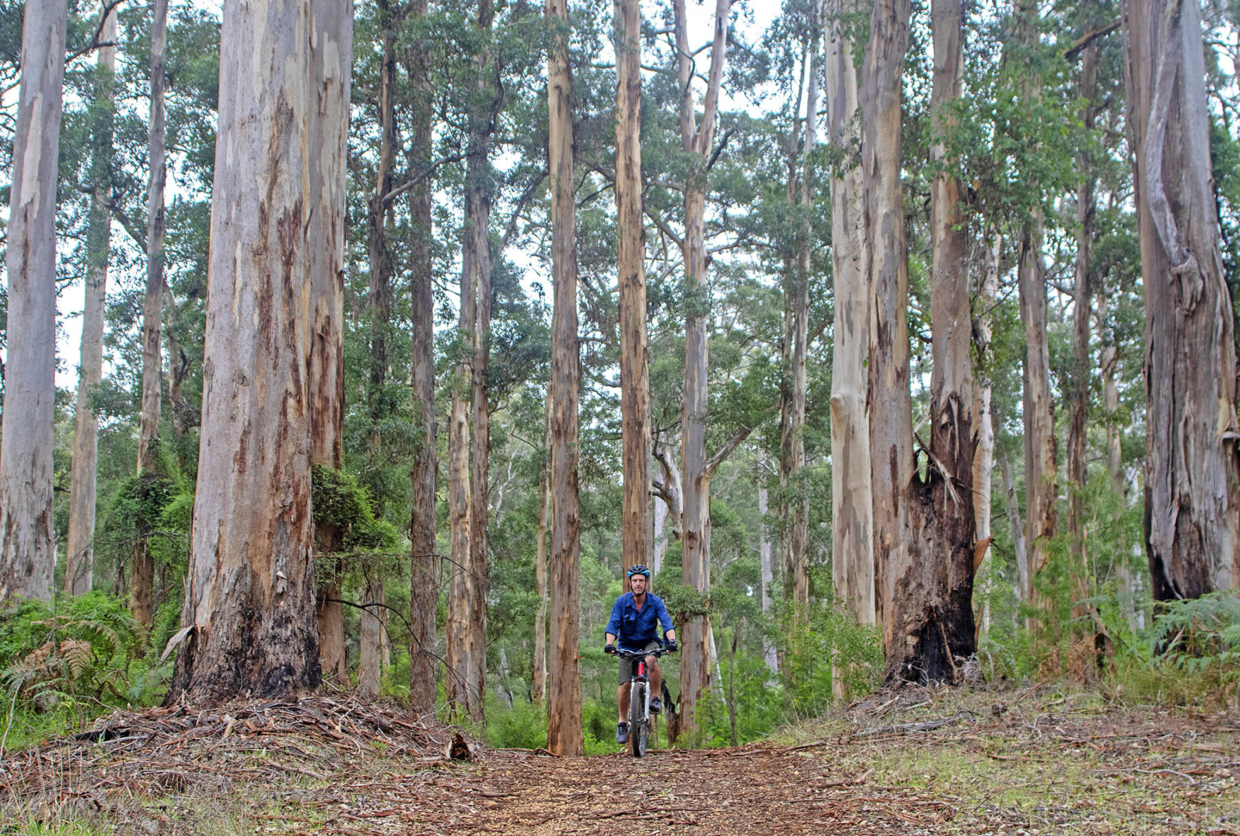
Running parallel to the Bibbulmun, the Munda Biddi (a name meaning ‘path through the forest’ in the local Noongar language) was purpose-designed for mountain biking and is thus one of the best equipped long-distance trails in the country. Though towns are up to 100km apart – about a two-day ride for most cyclists in this terrain – campsites have been spaced a day’s ride apart along the length of the trail (the longest gap is about 77km). Most of the campsites are exclusive to the trail, and feature covered sleeping shelters (accommodating up to 25 people), tent sites, rainwater tanks, picnic tables and bike storage shelters.
If you set out to average 50km a day – a reasonable ask in this terrain – it’s about a three-week ride to ride end to end, though the regular presence of towns makes it possible to ride single sections or complete the trail across a series of rides.
Enticing shorter sections include the forest delights from Manjimup to Pemberton (83km), and similar green goodness from Pemberton to Walpole (175km), or the coastal home stretch from Walpole to Albany (224km), which passes through the Valley of the Giants (with its treetop walk) and the town of Denmark.
Gibb River Road
Distance: 660km Grade: Advanced Bike: Gravel/MTB
The Gibb River Road is one of Australia’s most iconic outback routes. Stretching 660 kilometres from Kununurra on the WA/NT border to Derby in far north Western Australia, it transects the heart of the one of the country’s most rugged and remote regions: the Kimberley.
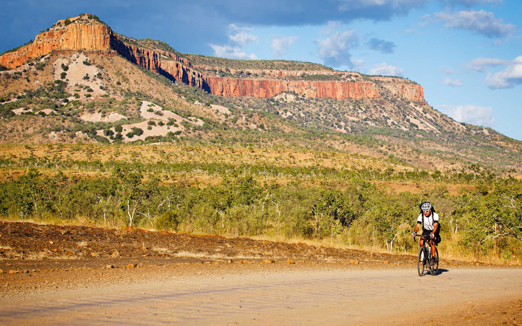
With its plunging waterholes, deep gorges and palm-fringed oases, and its dusty plains, sandstone ranges and bare knuckles of glowing rock, the Gibb has long been a magnet for four-wheel drivers seeking adventure. There are no towns along the road – just a sprinkling of huge cattle stations (most with supplies/water) and remote Aboriginal communities.
But it’s no longer as rough as it once was; the road has been upgraded dramatically over recent years and in the middle of the dry season (May-October) it’s even occasionally negotiated in a 2WD. However, despite much of the road being in reasonable condition, it remains primarily unsealed, and is still famed for its rocks, bulldust and, most significantly, bone-rattling corrugations. (Run tubeless tyres to minimise the chance of punctures.)
Cycle tourers have similarly been attracted to the Gibb River Road. Many do it on mountain bikes; others on touring or gravel bikes. Two weeks is a commonly suggested duration for the trip. It can be done more quickly, however, and a week is possible if you’re strong. Make sure you travel in the right direction, though. Winds in the dry season (May to September; the only time possible to ride the GRR) are overwhelmingly easterlies; go from Kununurra to Derby, with consistent tailwinds at your back, and it feels like you’re cruising a constant 2 per cent downhill grade.
QUEENSLAND
Brisbane Valley Rail Trail
Distance: 161km Grade: Intermediate Bike: Gravel/MTB
Australia’s longest rail trail begins its journey in rural Yarraman and finishes in Wulkuraka, at the suburban edge of Ipswich, less than an hour’s drive from Brisbane’s city centre. Traffic-free along its length, the trail descends through the Brisbane Valley as the river flows towards Brisbane, though the views are so faithfully rural that the presence of a city feels like a myth.

From Yarraman, the trail sets out through bush and cattle country, beginning its biggest descent (the trail drops approximately 350m between Yarraman and Wulkuraka) in Benarkin. This descent ends 18km later in Linville, a likely stopping point for the first night. The Brisbane River is first sighted beyond Linville, and not seen again until Lowood, around 85km later, leaving farmland and dry bush to dominate the views throughout. The old railway’s greatest legacy, beside the gentle gradients, is the Yimbun Tunnel, which bores through the hills for 100m just beyond Harlin.
The unsealed trail is lined with old railway trestle bridges that once spanned the many deep gullies that furrow the land, though the ride typically drops into the gullies, creating a series of short, steep descents and climbs that have many cyclists dismounting to push their bikes. The ride is lined with small towns – Blackbutt, Linville, Moore, Harlin, Toogoolawah, Esk, Coominya, Lowood, Fernvale – making it easy to structure days and to find food, rest stops and accommodation along the way. The greatest distance between towns is 24km. A private shuttle service, run by Out There Cycling, operates along the length of the trail.
Atherton Forest Mountain Bike Park
Distance: 54.4km Grade: Easy to Advanced Bike: MTB
Atherton is about an hour inalnd from the Tropical North Queensland ‘capital’ of Cairns, on the tablelands at a lofty 800 metres above sea level. Atherton is less busy (and a lot smaller) than Cairns, but with one big cycling-based asset: this town of 7000 is home to one of Australia’s most sensational trail networks – the Atherton Mountain Bike Park.
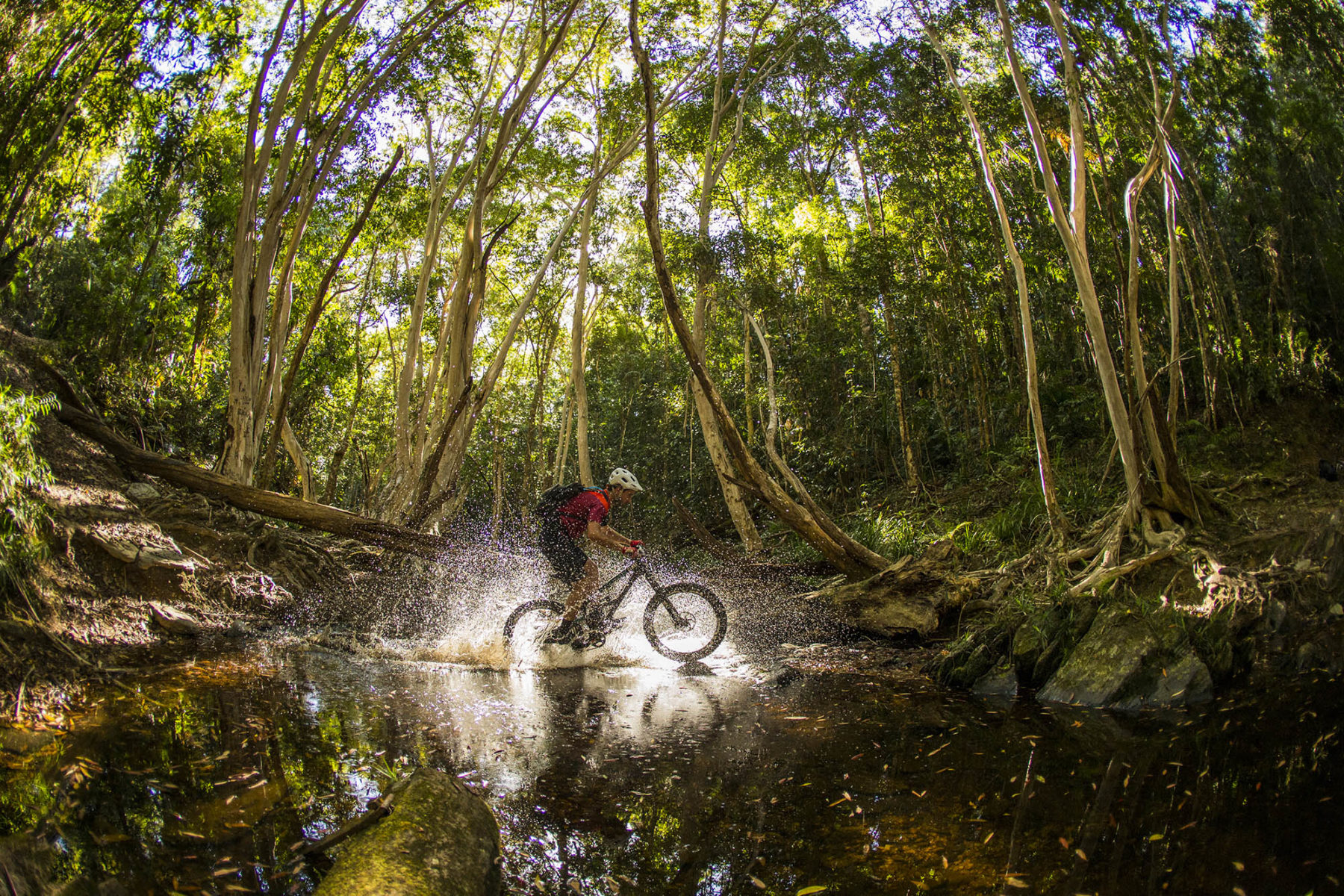
Atherton meets all the ‘successful mountain bike town’ criteria: a great climate, awesome terrain, and the chance to ride to the trail network directly from town. Indeed, the trailhead (with change rooms and bike-wash facilities) is right on the main street, with the link trail out to the network, for easy trail access/return. The 54.4km trail network sprawls over Baldy Mountain Forest Reserve and Herberton Range State Forest. Most of the riding is ‘flow’ trail, best suited to cross-country or trail bikes. There’s nothing too technical, although the ease with which you garner speed should be enough to keep you focused.
You will find the easier trails in the lowlands, while the intermediate trails cloverleaf off, taking you out into the hills. It’s a smart layout that’s ideal for groups of mixed abilities; in short, everyone has an awesome time riding, regardless of mismatched skill levels. The official trail maps are numbered; highlights include the bobsled descent of Trail 9 and the epic Trail 12, which loops off onto a life-changing descent and a scenic, gradual climb that takes you to the park’s highest point. For shorter loops, climb up to The Roundabout, and link up Trails 6 and 7.
Glass House Mountains Loop
Distance: 61km Grade: Intermediate Bike: Gravel/Hybrid
The craggy peaks of the Glass House Mountains are the slalom posts on this loop ride, which combines a rail trail with roads that thread between the striking volcanic mountains. It begins in Caboolture on the Caboolture-Wamuran Rail Trail, a 10.5km sealed path into Wamuran. After a quick pedal (4km) along the D’Aguilar Highway, the ride turns away again, onto the unsealed Wamuran Forest trail, which continues to follow a disused rail corridor through the Beerburrum West State Forest. Approaching the town of D’Aguilar, the ride swings north, beginning the approach to the Glass House Mountains.
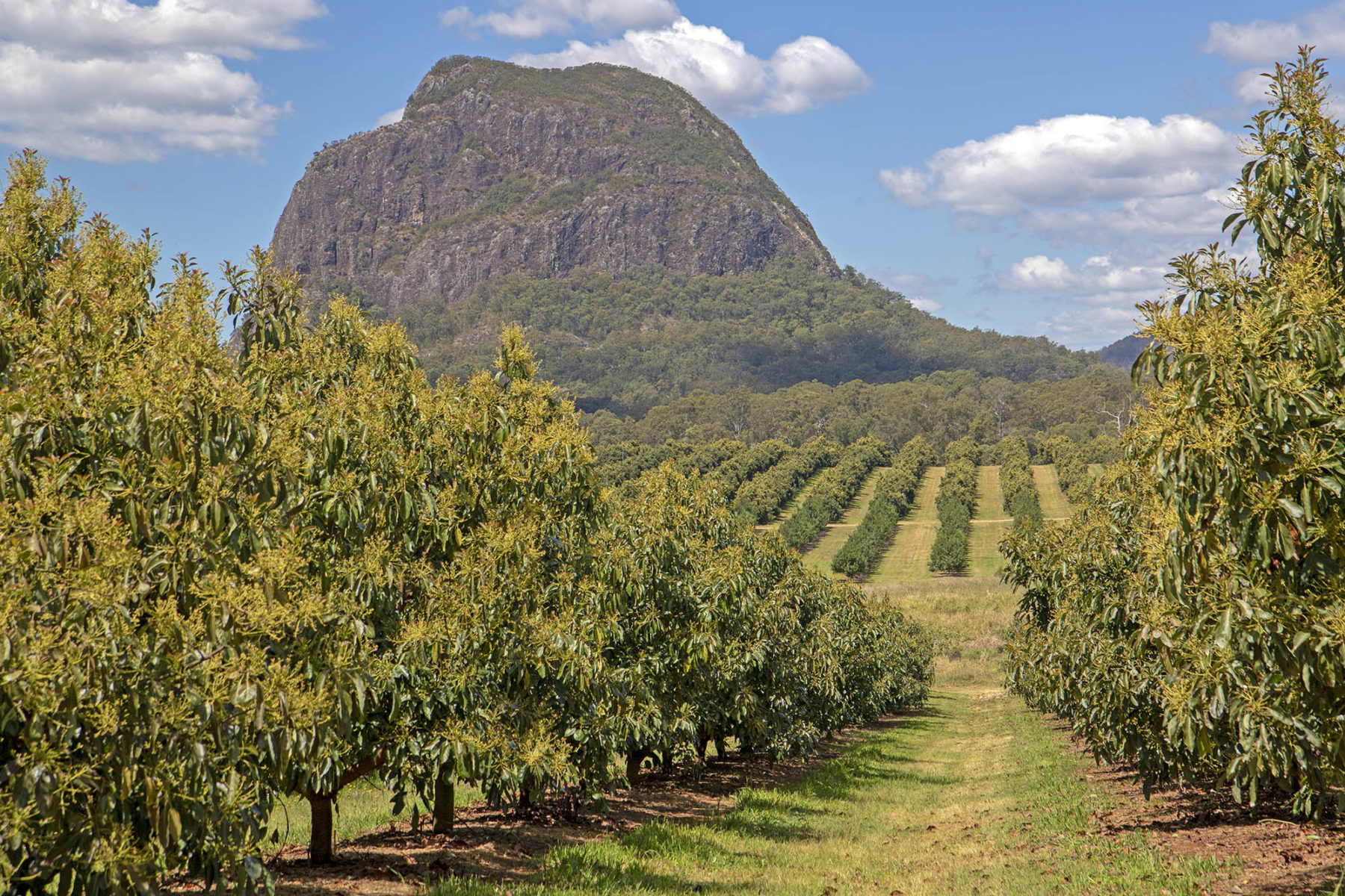
Weaving through more state forest, the ride takes to Beerburrum-Woodford Rd, finally arriving at the mountains on Old Gympie Rd, which is laid out like a grey carpet between the peaks. Through breaks in the forest along this sealed road, Mt Tibrogargan rises to the east, with Mt Coonowrin and Mt Ngungun beckoning you on ahead. It’s worth making the 1.5km detour to the Glass House Mountains Lookout Cafe, with its caffeinated view of Coonowrin. The Glass House Mountains Lookout is another 1km beyond if you really fancy another view – and another 70m of climbing.
Turning towards the town of Glass House Mountains on Coonowrin Rd, there’s a roadside bike path, squeezing between Tibrogargan and Ngungun, with the chance to double back to Ngungun, where a 2.8km return walking trail ascends to the summit for one of the area’s signature views. Joining busier roads in the Glass House Mountains township itself, it’s a single-minded 20km return to Caboolture, passing through the town of Beerburrum.
SOUTH AUSTRALIA
Mawson Trail
Distance: 900km Grade: Advanced Bike: MTB/Gravel
Stretching from Adelaide’s outskirts to Blinman, this mighty off-road ride is as challenging as it is scenic, traversing the Adelaide Hills, cutting through the wine regions of the Barossa and Clare valleys, and rolling towards its finish beside the outback peaks of the Flinders Ranges. It begins at the foot of the Adelaide Hills, setting off immediately into perhaps its most difficult climb to Lobethal – there are pinches above 20 per cent gradient to test your early resolve.

Beyond Mt Crawford, the trail dips into the Barossa Valley, passing through a world of cellar doors as it wriggles through Tanunda and Nuriootpa to Kapunda. In Auburn, 65km beyond Kapunda, it momentarily takes things easy as it joins the sealed Riesling Trail to Clare (another day, another wine region), before beginning a wildly circuitous path across the Mid North – between Burra and Spalding, the trail covers around 130km, though the towns are just 40km apart by road.
From Laura, the trail rolls along beside the mountains, passing beneath Mt Remarkable (the Southern Flinders Ranges’ highest peak) and making its way towards the desert country – and the associated sandy and corrugated tracks – of the Flinders Ranges. The final 300km are the Mawson Trail’s coup de grace, following the red line of the Flinders Ranges past Wilpena Pound and up to the pub door in Blinman.
Towns appear regularly, though there are gaps of more than 100km, making detailed planning prudent, especially around access to water and accommodation. Avoid riding this trail through the baking summer, while the winter mud can be thick and impassable – I once snapped two rear derailleurs in a day in the Mawson’s gelatinous mud.
Melrose
Distance: 230m-6.6km Grade: Easy to Advanced Bike: MTB
Scratched into the slopes of Mt Remarkable, the tallest peak in the southern Flinders Ranges, the Melrose trail network covers around 100km, split into three sections: Melrose Town Trails, Bartagunyah and Willowie Forest. The Melrose Town Trails form the heart of the network. Leaving from the very centre of town, they set off in all directions across and up the slopes of the mountain. The signature trails are arguably Weaving Camels and Dodging Bullets. The former is a 1km blue (intermediate) trail that rolls along the banks of Willochra Creek, set beautifully among large river red gums and functioning as an access trail to the southern end of the network. Here, the blue Big Rhua and a selection of black trails coil up the slopes to Wilburs Watch, a ridge-top building with extensive views over Melrose and the flat earth well beyond.
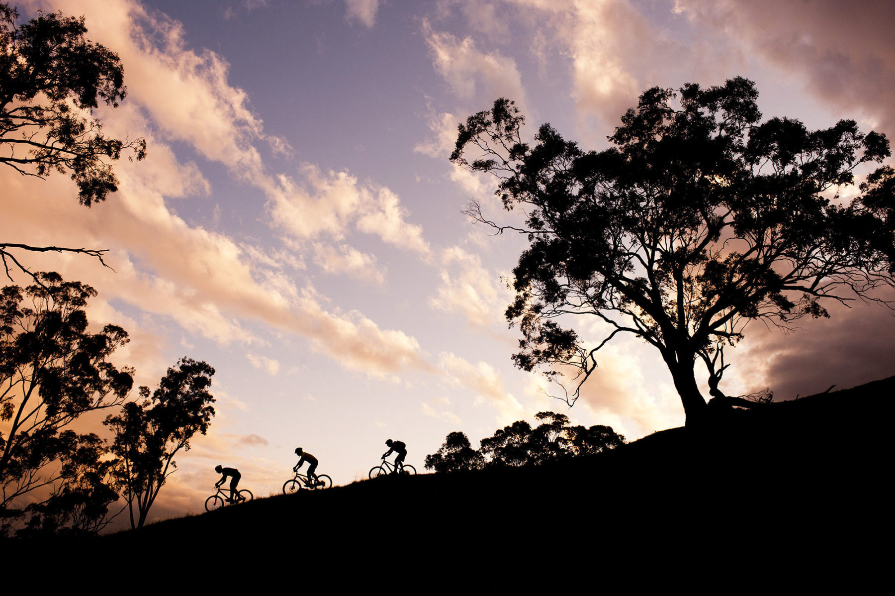
Dodging Bullets is a playful Black run that dips through a concrete pipe and, near its end, cuts through the middle of a tumbledown farmhouse – how many chances will you ever get to ride through a house? The Town Trails are, by nature, exposed, with trails hanging over steep drops. The giddying sense of exposure, more than any technical trickery, means many trails are graded higher than they might be on less precipitous terrain.
Willowie Forest, 8km north of town, has good offerings for novice riders, especially on the flowing Twisted Sisters. Bartagunyah, on a private property 5km south of town, is a more unmaintained, rough-and-ready collection of trails.
Encounter Bikeway
Distance: 31km Grade: Easy Bike: Any
Showing off one of South Australia’s favourite holiday coasts, this seaside cycle stretches along the southern edge of the Fleurieu Peninsula, taking in the likes of Victor Harbor, Port Elliot and Middleton Beach as it journeys from The Bluff to Goolwa. From a car park on the slopes of The Bluff (it’s worth walking to the top of the 97m-high headland for a view over Encounter Bay and much of the ride ahead), the bikeway drops to the shores of Encounter Bay, following a foreshore path into Victor Harbor.
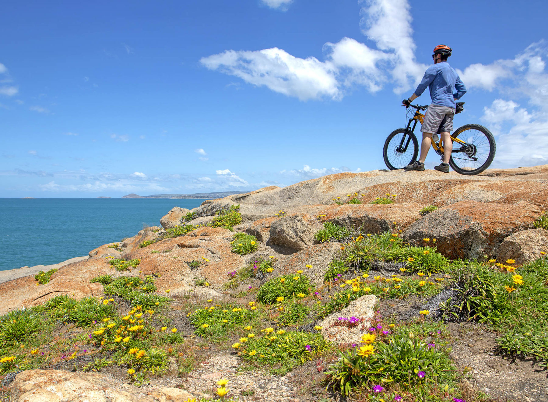
As Victor’s causeway stretches across the water to Granite Island, the ride turns with the coast, continuing to run pinched between the sand and the town. Crossing under a railway bridge and over the Hindmarsh River, the ride becomes a combination of bike paths and streets, but it always stays close to the coast – if you’re riding between May and September, keep a watch on the sea, especially along Boomer and Basham beaches, where southern right whales are regularly sighted.
The ride stays with the coast to Middleton, where it cuts briefly inland to Goolwa, the town sitting on the final bend in the Murray River’s long journey – the river mouth is just 10km away from here. The bikeway heads upstream from Goolwa, finishing abruptly and anticlimactically at Laffin Point. A more fitting finish is at the Goolwa Wharf (3.5km before Laffin Point), beside the Hindmarsh Island Bridge. It’s home to a distillery, eateries and a cellar door/craft brewer. Time the ride right and you (and your bike) can return to Victor Harbor on the Cockle Train, riding Australia’s oldest steel-railed railway.
Want more awesome bike rides? Grab yourself a copy of Australia’s Best 100 Bike Rides here.
