Gallery: New Zealand’s 9 Great Walks

The four-day, 54km Milford Track is The Big One – and one of the most strictly controlled Great Walks. In peak season, only 40 independent and 40 guided walkers can start the Milford each day, all walking in one direction: from Glade Wharf (at the head of Lake Te Anau) to Sandfly Point, at Milford Sound. So why’s it so special? It’s a microcosm of Fiordland; one of the world’s last unspoilt wilderness areas.
Hikers disembark at Glade Wharf, then day one is a 5km walk to Clinton Hut. The work starts day two, with a 16.5km tramp through the Clinton Valley, following the Clinton River, to Mintaro Hut, at the base of Mackinnon Pass.
Leaving Mintaro Hut on day three, the track climbs towards Mackinnon Pass where, in the final stages, you negotiate a switchback track to the pass. From here, the views are spectacular: glacial-carved valleys and mountains, such as Mt Pillans and Mt Hart surround this high point.
Take a deep breath because, after this, it’s a knee-crushing descent to the Arthur River valley below. Your legs – already shaky from the ascent – have to work twice as hard to keep you upright as you descend. It’s a huge day but, with the challenging walk and the 580m Sutherland Falls (one of the world’s tallest), you won’t forget it. The next day is a flat (18km) walk to Sandfly Point, via the Mackay Falls sidetrack. From Sandfly Point, it’s a water taxi across Milford Sound to Milford Lodge or a bus back to Te Anau.
Photo Credit: Amy RussellActive volcanoes, craters and a small desert crossing (yes, there’s a desert in NZ) are highlights of the Tongariro Northern Circuit. In the centre of the North Island, this walk is like entering a primeval world, with the volcanic, lunar landscape offering a dramatic contrast to the lush terrain of other Great Walks.
The Northern Circuit starts in the skiing village of Whakapapa, below the slopes of Mt Ruapehu. Walkers head north along the Mangatepopo Track, east of Mt Ngauruhoe. You will cross a number of creek beds and volcano vents, travelling through the Mangatepopo Valley to the hut of the same name for the first night on the track.
Next morning, walkers climb to Mangatepopo Saddle, then traverse the South Crater’s lava flows (from nearby Mt Ngauruhoe). It is hard going – especially if it’s windy. However, once you reach the top of the Red Crater (which, funnily enough, contains plenty of red lava), the vista below – the craters, Emerald Lakes and Blue Lake – is awesome.
The track then descends to the Emerald Lakes and veers right, heading towards Oturere Hut. Descending into Oturere Valley, walkers travel through a lunar landscape, with ragged lava formations surrounding them, before reaching the Rangipo Desert and, after that, Oturere Hut. Walkers can stay here overnight or walk two more hours to Waihohonu Hut.
From Waihohonu Hut, there’s more contrasting scenery as the track leads through patches of beech forest and more volcanic terrain. Taranaki falls is the next stop-off, before the track joins the falls loop track (one hour) back to Whakapapa village and track’s end.
Photo Credit: Justin Walker
At 74.8km, the Heaphy is the longest Great Walk. In Kahurangi National Park, in the South Island’s north-west corner, the Heaphy can be walked in either direction and offers a wide variety of terrain, such as grassy flats, alpine tussocks, beech forest, tropical forest and west coast beaches. There are seven huts and nine camp sites.
Walking east to west, you start at Brown Hut, in Golden Bay. This means the track’s steepest section – a 17.5km walk to ascend 800m to Perry Saddle Hut – is tackled first. This is a gradual ascent, with creek crossings and views along the way to Mt Olympus and the Dragons Teeth mountains. The highest point is 915m Flanagans Corner, a lookout accessed via a side-track.
The next day’s descent travels across Gouland Downs, a plateau of open tussock country. Walkers traverse a mixture of eerie plateau, tussock fields and dense forest before reaching James Mackay Hut. Here, you get your first glimpse of the Heaphy River and the Tasman Sea, about 750m below the hut.
On day three, the track drops into lush, coastal/tropical forest to the Heaphy River, passing Lewis Hut, on the way to Heaphy Hut. The different plant life – a consequence of the west coast’s higher rainfall and the lower altitude – is a real contrast to the previous days’ alpine vegetation.
The final day is spent following the Heaphy River on its south-west journey to the Tasman Sea. Walkers soon reach this point, before turning south along the west coast sands, towards Kohaihai Shelter and track’s end. A mighty walk!
Photo Credit: Derrek MorrisonThe 32km Routeburn is a must-do. Straddling Fiordland and Mt Aspiring national parks, it involves three days of ascents and descents, plenty of creek crossings (bridged) and a full day walking above the tree line. The Routeburn can be walked in either direction and there are four huts and two designated camping areas.
Starting from the east, at Routeburn Shelter in Mt Aspiring NP, the track leads through beech forest and crosses numerous creeks and rivers before reaching the Routeburn Flats Hut and camp site turn-off. The preferred option is to continue ahead, starting the hour-long, very steep climb to Routeburn Falls Hut, perched just above the tree line with awesome views across to Mt Somnus and the valley below.
The second day is brilliant – a full day above the tree line. On the way to Mackenzie Hut, walkers pass Routeburn Falls, then continue climbing over alpine terrain before reaching Harris Saddle (1255m, the track’s high point). From Harris Saddle, you descend along the spine of the Serpentine Range (with the Hollyford River below) for three hours before a short descent to Mackenzie Hut, at the foot of Lake Mackenzie.
Day three starts with a gradual climb through forest before reaching The Orchard, a natural clearing. An hour later, you arrive at Earland Falls, before descending to Lake Howden Hut. Stay the night here or continue 1.5 hours to The Divide, the track’s finish. Don’t miss the Key Summit side-trip (one hour) at the top of the climb from Lake Howden Hut. The views are spectacular.
Photo Credit: DOC/90 SecondsBuilt to take some of the “tramper load” off the nearby Milford and Routeburn tracks, the 60km (three- to four-days) Kepler has become a sought-after trek in its own right. Dense forests, alpine vegetation, exposed mountain ridges and steep climbs and descents make it very popular.
The Kepler can be walked in either direction, starting at Lake Te Anau Control Gates or, if you wish to walk clockwise, from Rainbow Reach (accessed via shuttle). Most walkers will complete the Kepler in three days, staying at two of the three huts (or two camp sites) on the track.
Starting at Rainbow Reach, the first day can be either a flat, two-hour stroll through beech forest to Moturau Hut, on the shores of Lake Manapouri, or a 22km journey to Iris Burn Hut.
From Iris Burn Hut, it is a steep, zigzagging climb of about 890m up through sub-alpine forest to Hanging Valley Emergency Shelter (1390m) on the exposed – but breathtaking – ridge line. In adverse conditions (it can snow here any time of year), this exposed section can be dangerous, but the two emergency shelters (Hanging Valley and Forest Burn) provide protection. The track follows the ridge line from here, to Luxmore Hut (overlooking Lake Te Anau), via the side trip to 1472m Mt Luxmore if the weather is clear.
The final day from Luxmore Hut is a descent through mixed vegetation – and past a massive, 200m-long, 60m-high limestone “wave” rock formation – to either Brod Bay, for a water-taxi trip across Lake Te Anau, or around to the Control Gates and on to Te Anau itself.
Photo Credit: Justin WalkerIn the North Island’s Te Urewera NP, Lake Waikaremoana Great Walk covers 46km (over three or four days) of moderate walking terrain, as it circles this young lake (estimated to be a relatively youthful 2200 years old).
The track can be walked in either direction (from Hopuruahine Landing in the north, or the south’s Onepoto entrance), with the decision coming down to whether you want to tackle the steep climb to Mt Pukenui on the first day or the last.
Starting at Hopuruahine Landing, walkers follow the track anti-clockwise along the lakeshore, through vegetation such as beech, tree ferns and rimu forest, before reaching Tapuaenui camp site after about five hours. From here, another three hours takes you to Waiharuru Hut.
The next day is long (18km) if walkers want to reach Waiopaoa Hut. Initially, the track continues to follow the shoreline before traversing small ridges and crossing lakeside flats, while gaining altitude on the way to Korokoro camp site (with a side track to Korokoro Falls), then Waiopaoa Hut.
Climbing starts in earnest the following day, with the track following ridges up the Panekire Range toward Panekire Hut. This section is strenuous but rewarding. “The views from Panekire across the lake, and to the ocean on the other side, are totally captivating,” says DOC ranger Jane Hughes.
The final day’s descent includes the must-see viewpoint of Panekire Bluff, with lake and mountain views, then the track follows the Panekire Range down towards the Onepoto finish.
Photo Credit: Justin WalkerOn Stuart Island – New Zealand’s ‘third island’, below the South Island – the 36km Rakiura promises plenty of wild weather, mud and remote coastal walking. The rugged conditions mean you’ll need extra clothing and it is wise to double- or triple-pack your gear in waterproof plastic liners. The Rakiura has two DOC huts and three camp sites.
The track begins in the township of Oban, the main settlement on the island. The track follows the road north to Lee Bay, travelling along the coastline, before the walkers-only track is reached near Lee Bay. Walkers can opt to catch transport to Lee Bay if walking on bitumen roads doesn’t appeal. From Lee Bay, the track continues around to Peter’s Point, then past the Maori Beach camp site before reaching Port William Hut, set above Magnetic Beach, overlooking Port William.
Day two begins with a backtrack to the track junction at Wooding Bay, before a small climb takes walkers to a lookout tower on the summit ridge, which offers views back across Port William and west to the island’s interior. From the lookout, it’s a short descent to North Arm Hut, right on the inlet’s shoreline.
Following the coastline south to Sawdust Bay campsite, the track then crosses a small peninsula to Prices Inlet. From here, walkers drop down into Kidney Fern Arm and then Kapipi Bay. After this coastal walk, the track veers inland, moving east to Kaipipi Road, which takes walkers back to Oban.
Photo Credit: DOC/90 SecondsAbel Tasman Coastal Track
The most popular Great Walk, the 52km Abel Tasman Coast Track is often viewed as the easiest. For those looking to undertake a four-day walk along some of the country’s most beautiful coastline – or introduce younger family members to their first multi-day adventure – it is ideal. There are four huts and 19 camp sites on the track, which winds along the South Island’s north-west coast.
Starting at Marahau in the south, the track follows the coastline and ventures inland at various points on the first day. Secluded bays, usually just off track, make worthwhile diversions before the undulating track leads to a ridge above Anchorage Hut, on Torrent Bay’s eastern edge.
For those walking the track in four days, the second day, at 21km, is the longest. The track winds up and around Torrent Bay before it heads inland on the way to Bark Bay Hut, the site of the first tidal crossing (although there is a side track that can be taken at high tide). From here, the track goes further inland, before turning back to the ocean at Onetahuti Beach and climbing slightly to Awaroa Hut.
Another low tide-only crossing – the Awaroa estuary – is negotiated the next day before walkers traverse a low saddle and continue to Waiharakeke Bay. The beautiful Goat Bay is next as the track continues towards the day’s final destination, Whariwharangi Bay Hut.
The final day is the shortest. The track follows a small stream behind the hut before a short, steep climb takes walkers over a saddle that has views across Wainui Inlet before descending to its edge. Once down, it is about 500m to the track’s end at the Wainui DOC car park.
Photo Credit: DOC/90 Seconds
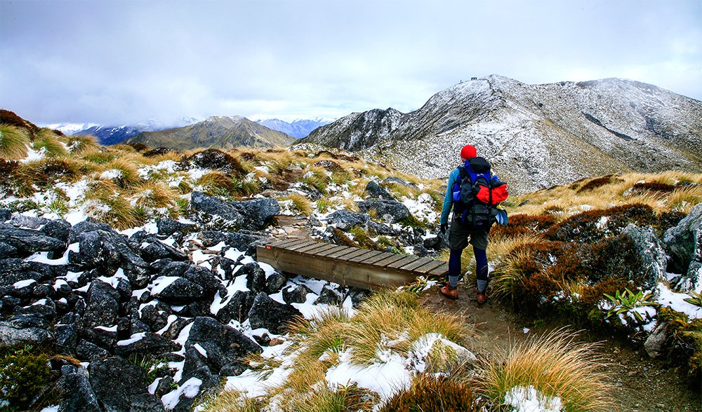
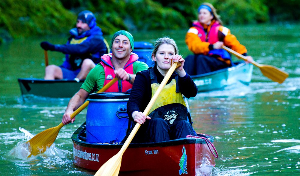
Walking on water – a Kiwi miracle? All jokes aside, the 145km, water-borne Whanganui Journey provides a unique experience for those keen to complete the nine Great Walks.
This adventure starts at Cherry Grove, near Taumarunu and takes about five days, finishing in the south near Pipiriki. There are said to be about 249 named rapids on the Whanganui River but (at normal water levels) none are above a Class II. There are three huts (Whakahoro, John Coull and Tieke Kainga) and 10 camp sites on the journey. The preferred craft is a canoe, due to its load-carrying ability.
Most of the rapids are encountered in the first two days, as paddlers make their way to Whakahoro Bunkroom, stopping overnight at Ohinepane camp site, 22km from Cherry Grove. From Ohinepane, paddlers continue to Whakahoro Bunkroom, passing historical Maori niu poles near Ohura Falls.
From Whakahoro Bunkroom, the river flows through the beautiful Whanganui Gorge, with intermittent rapids breaking up long stretches of still water. South of Mangapapa camp site, paddlers will spot Tamatea’s Cave (named after a Maori chief) before passing Ohauora camp site and then, 10km on, reaching John Coull Hut.
Leaving John Coull Hut next morning, paddlers head towards Tieke Kainga, passing the confluences of the Tangarakau and Whangamomona rivers. Along the way is Mangapurua camp site, where paddlers can take a short trek to the Bridge to Nowhere, which does go nowhere and is evidence of nature winning out over human development.
Tieke Kainga, now a hut but formerly a Maori village, is the last overnight stop and offers a terrific insight into Maori culture. From here, the river leads through the Whanganui Gorge’s deepest section before paddlers attempt the river’s three largest rapids. After this excitement, the river enters more “civilised” country, with low farmland on both sides, before the take-out point at Pipiriki.
Photo Credit: DOC/90 SecondsHome Australian Geographic Adventure Destinations Gallery: New Zealand’s 9 Great Walks