Indigenous Ice Age exodus

Dr Karl Kruszelnicki
Dr Karl Kruszelnicki

During the last Glacial Period (LGP or Last Ice Age), which began about 120,000 years ago and ended about 11,500 years ago, up to 500,000 First Nations people lived on bountiful Australian lands, which were later covered by rising ocean levels as ice melted and that LGP came to an end.
At its height, the ice was 3km thick over modern-day Quebec in Canada. The water to make all this ice came from the oceans, so the sea level dropped. The intensity of the LGP varied during its 100,000-year span, dropping sea levels 40–120m lower than they are today. In fact, they were so low that a person could walk entirely on dry land from Tasmania to New Guinea.
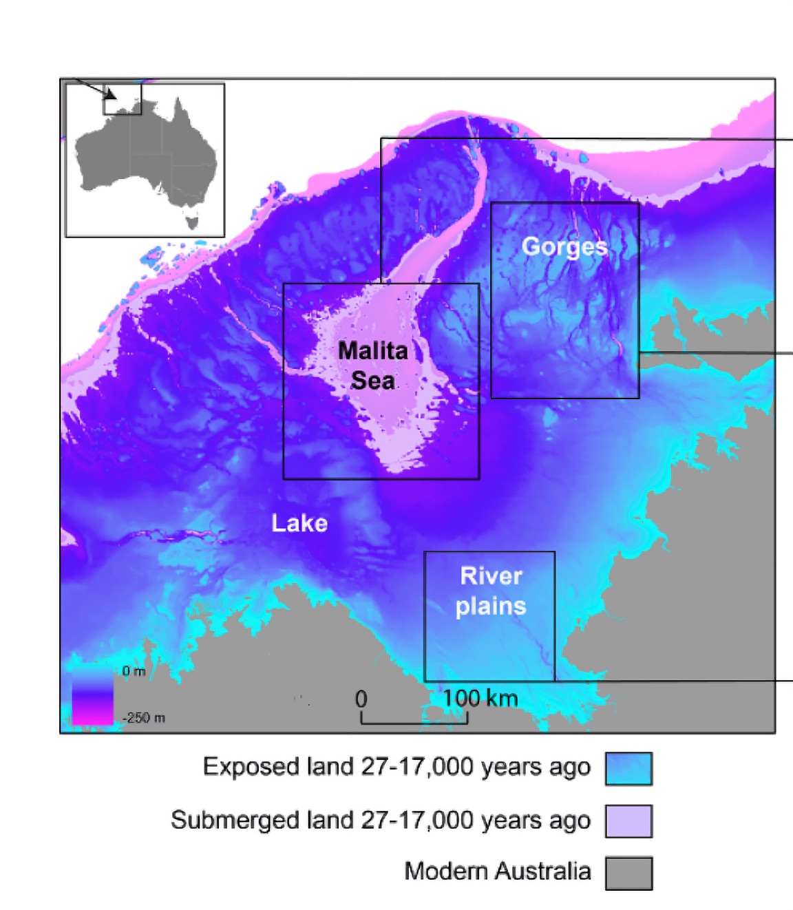
Another exposed coastal margin was Australia’s North West Shelf – west of Darwin and north of the Kimberley. Back then, some 400,000sq.km was dry land, which was roughly five per cent of Australia’s current surface area.
The continent had an inland salty sea joined to the oceans by a narrow neck. It also had Lake Kimberley, a giant inland freshwater lake. The surrounding area was varied – with plateaus and deep gorges, and many rivers and waterholes.
As the planet transitioned from the LGP to our current “interglacial” period, there were two relatively rapid periods of global ocean level rise. The first took place over a 400-year period from about 14,000 years ago, when the water rose some 20m – about 5m per century.
The second took place between 12,000 and 9000 years ago, rising the same amount. That means that over both these periods, the rising water rapidly covered about 50 per cent of the North West Shelf.
Ultimately, Earth came out of that LGP, and the ocean levels rose even higher. Many First Nations communities were forced to abandon their land. We have Indigenous stories accurately describing features covered by the rising ocean, going back thousands of years. These stories come from Melville Island (north of Darwin), Rottnest Island (west of Perth), the Spencer Gulf (north-west of Adelaide), Moreton Bay (off Brisbane), Botany Bay (in Sydney) all along the Great Barrier Reef, and many other places.
Today, all traces of where inhabitants once lived now lie beneath the waves.

