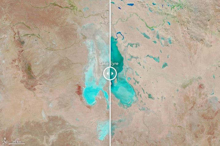
NASA captures the flooding of Kati Thanda-Lake Eyre

ON TUESDAY, NASA posted to its NASA Earth page, revealing incredible comparison images of Kati Thanda-Lake Eyre in 2018 and 2019.
“The false-color images were composed from a combination of infrared and visible light (MODIS bands 7-2-1),” they wrote.
“Water appears dark and light blue; bare ground is brown; and vegetation is bright green. This band combination makes it easier to see where water is present.
“Water first filled two narrow channels that run north to south; then it begun to pool in the southernmost part of Lake Eyre North.
“The natural-color images below, acquired by the Operational Land Imager (OLI) on Landsat 8, provide a closer view of muddy water flowing into the lake on May 5, 2019.”


