Top 8 wilderness camping spots in Australia

THERE’S NOTHING MORE Aussie than heading away camping, so we’ve done the hard work for you to come up with the best wilderness camp sites in Australia. Enjoy!
1. The Grampians NP, VIC
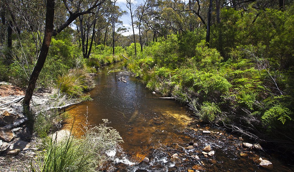
The flow from the Mackenzie River feeds the famous falls downstream. (Image: Bill Bachman)
Magnificent summits, spectacular lookouts over waterfalls, and refreshing treks through lush forests – the Grampians is an adventure lover’s paradise. A network of more than 30 tracks makes walking and hiking in this national park a simple trip to plan. Various levels of difficulty – from sedate paths to challenging treks – and an abundance of things to see, mean that there is a walk to suit everyone. Take on a challenge and map out an overnight hike – there are remote campsites throughout the park, like Borough Huts and Boreang campgrounds, that make multi-day adventures possible.
For the history buffs, a walk through the northern Grampians will take you past Aboriginal rock art and the Heatherlie Quarry, once famous for its high production of Grampians freestone used in buildings such as the Melbourne Parliament House. Trekking through Wartook Valley in the north-west section of the park will bring you to the Grampians’ famous Mackenzie Falls. In the southern Grampians, a number of strenuous and dramatic walks are rewarded with outstanding views in all directions, including a breathtaking view from the summit of Mt William. For dramatic lookouts make time for walks to Briggs Bluff (6 hours), Tilwinda Falls (45 minutes from Troopers Creek campground), and Reed Lookout (45 min from Reed Lookout carpark).
Getting there: Grampians National Park is about 260km north-west of Melbourne. Public transport is available on the V-line from Melbourne (about 5 hrs), taking you from Southern Cross to Stawell. Catch a bus from Stawell station to Halls Gap. A car ride will get you there in about three hours along the Western Freeway.
When to go: Temperatures stay spring-like from October through to April, with maximum temperatures reaching from 20-30˚C and minimums ranging from 7-14˚C. Whenever you decide to go, prepare for any kind of weather change.
Camp: Halls Gap is easily accessible and a great spot for visitors to the park; plenty of accommodation is available here. Toilets and fireplaces can be found at the campsites, but you will need to bring your own drinking water. No booking is required but there is a $12.50 site fee per night; call the staff at Brambuk National Park and Cultural Centre on (03) 5361 4000, or visit www.parkweb.vic.gov.au/explore/parks/grampiansnational-park.
2. Hinchinbrook Island NP, QLD
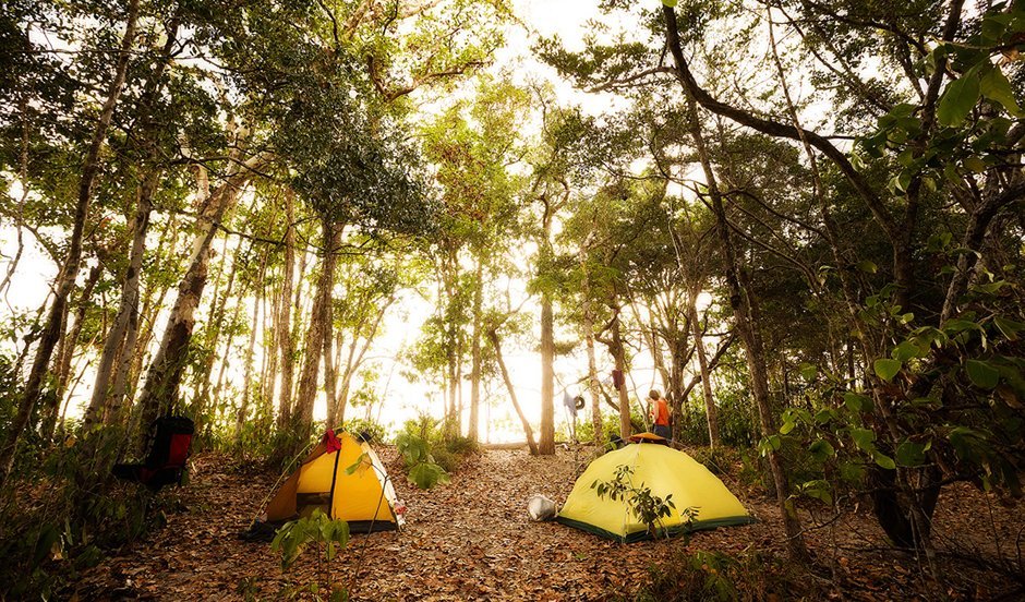
Little Ramsay Bay Campsite on Hinchinbrook Island. (Image: Drew Hopper)
Walk through extensive woodlands, mangrove forests, sandy beaches, palm wetlands, and rocky headlands on the tracks of Hinchinbrook Island. Surrounded by marine park waters, Hinchinbrook Island is one of our largest island national parks.
Take your pick from the four walking tracks on the island, all ranging from a short and easy 3-5km boardwalk stroll through Edmund Kennedy National Park to the challenging 32km Thorsborne Trail. The moderate 5.4km Macushla to Cape Richards track provides picturesque views of the North Shepherd Bay and a chance to spot various types of wildlife, from crabs to sea eagles. For a more inland route, a 6km sidetrack to South Shepherd Bay is available about 1km from Macushla. The track winds through the forests of Kirkville Hills and onto South Shepherd Bay beach, often devoid of other visitors.
The Thorsborne Trail covers an array of landscapes including eucalypt forests, rainforests, and mangrove fringes. Careful planning is essential, as this is not a hardened track. Head south from Ramsay Bay or north from George Point, and you must be totally self-sufficient. Permits are required for access ($5.15 pp/pn); call 131 304 or visit www.qld.gov.au/camping for more information.
Be aware of dangerous stinging jellyfish and estuarine crocodiles in the waters surrounding Hinchinbrook Island. But don’t be scared to get close to the water – there are plenty of opportunities to see the green sea turtles and dugongs that live there too.
Getting there: From Cardwell, 171km north of Townsville and 203km south of Cairs, Hinchinbrook Island is 8km away, and can be accessed in approximately 45 minutes by private vessel or water taxi services, or by the Hinchinbrook Island Ferries, which run daily from May-October and three times weekly from November-January. Call Cardwell Rainforest and Reef Visitor Information Centre: (07) 4066 8601.
When to go: The cooler, dry months of May-October are the best times to visit. All temperature extremes can be experienced, so pack for hot and humid days reaching up to 27˚C and cold nights that can drop to 9˚C . Bookings are recommended well in advance due to a limit of 40 people permitted on the track at any time.
Camp: Camping permits are required for Hinchinbrook Island and cost $4.50 for each night. Bookings are available online, and once at the island, camping tags must be displayed at your site. Camp sites are available at Nina Bay, Little Ramsay Bay, Banksia Bay, Zoe Bay, Sunken Reef Bay, Mulligan Falls, and George Point. For environmental safety, camping is not permitted at or above Zoe Falls. The island also only caters to the self-reliant; pack everything you’ll need, including plenty of water, food, and fuel stoves,as fires are prohibited. Visit www.derm.qld.gov.au/parks/hinchinbrook/about.html.
3. Flinders Ranges NP, SA
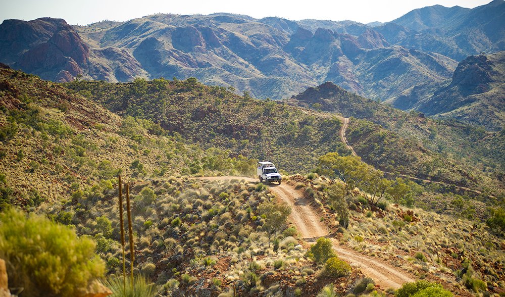
4WD tracks for all levels can be found at the Flinders Ranges (Image: Adam Bruzzone/SATC)
Tucked inside the middle of South Australia is a place with rugged mountain ranges, picturesque landmarks and gorges, and an abundance of wildlife, including the rare yellow-footed rock-wallaby. Spend a few days in Flinders Ranges National Park and you won’t be disappointed.
There are a variety of walking tracks that highlight some of the park’s best spots, including the Heysen Range, Brachina and Bunyeroo gorges, as well as the breathtaking Wilpena Pound. Take your pick from four walks and 14 hikes – all that’s required is a quick check-in with the Bushwalkers Register at the Wilpena trailhead if your planned hike will take three or more hours. A favourite track is the St. Mary Peak hike – and for good reason. Choose between the 14km or 21km trek; both options reward hikers with a finish at the highest peak in Flinders Ranges, providing spectacular views of the ranges, lakes, and plains surrounding the area.
Getting there: Flinders Ranges National Park is located 450km north of Adelaide between Hawker and Blinman.
When to go: Ideal temperatures (averaging 24˚C max) from April to October make this period the most comfortable for bushwalking. During the summer, temperatures can get up to 45˚C. Also note that the famous 1200km Heysen Trail is closed each year between 1 December and 31 March and on days of Total Fire Ban.
Camp: Enjoy the peaceful surrounds of the Flinders Ranges by setting up camp at Wilpena Pound, Bunyeroo Gorge, Brachina Gorge, and Aroona Valley. These sites have toilets and fire pits with cooking grills. Camping is also allowed along the Heysen Trail. $12 camping fees apply, so be sure to stop at the Wilpena Pound Information Centre for camping inquiries. Contact the staff at Flinders Ranges on (08) 8648 0048. Descriptions of trails, maps, and more information about the park is available at the Environment SA website.
4. Snowy River NP, VIC
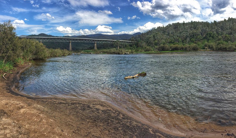
McKillops Bridge is one of the few places in the park with access to the Snowy River by conventional vehicles. (Image: Colin Adland)
If you like quiet days on a spectacular, isolated river, then pack up your camping and paddling gear and head to Snowy River National Park. Rugged gorges, rapids, and flat sections with sand bars make the Snowy River ideal for whitewater rafting and canoeing. Camping is plentiful on the river’s sandy beaches.
McKillops Bridge, just off of McKillops Road, is one of the few destinations in the park that provides access to the river by vehicle. This makes the bridge one of the best places to launch a canoe and explore the gorges downstream. The 67km trip from McKillops Bridge to the Buchan River junction is a favourite four-day adventure of paddling enthusiasts. This trip opens up opportunities to see amazing features such as Little River Gorge and Tulloch Ard Gorge. The rapids on this river are generally class II-III with some parts reaching class IV, making for an eventful journey with a slight challenge.
Getting there: Snowy River National Park is about 390km north-east of Melbourne and 318km south of Canberra. The drive to McKillops Bridge is through some rugged yet attractive country and can be reached from a number of directions. From the north, the Barry Way through Jindabyne and the Bonang Main Road from Bombala provide great access, and the Princes Highway gives the best access from the south. Note that many roads are unsealed, narrow, winding.
When to go: Spring is the ideal season for most water-goers. The river’s water level fluctuates frequently; the levels can be too low in summer but can rise quickly in winter and spring.
Camp: There are several campsites throughout the park; the Balley Hooey camping area sits due east of Buchan, just off of Buchan-Orbost Road. The Little River Junction camping area is nestled where the Snowy and Little rivers meet and can be accessed from Bonang-Gelantipy Road (commonly called Mckillop Road). Vehicle-based camping is only allowed at designated campsites, but walkers and kayakers are permitted to camp offsite as long as it set up at least 20m away from any water and 1km away from a designated site. No bookings or fees are required to camp in the park. www.parkweb.vic.gov.au
5. Margaret River region, WA
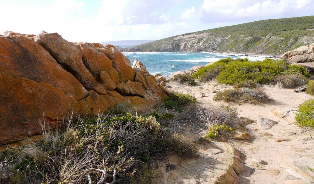
Leeuwin Naturaliste National Park, Margaret River, WA. (Image: Deb Etheredge/flickr)
Spectacular Margaret River is the place to spend time surrounded by nature, beautiful vineyards, and a vivid coastline. Here, it’s all about enjoying the water.
A trip to Margaret River also provides an opportunity to go whale watching without the crowds. Make your way to Augusta, a section of the Margaret River region where humpback, southern right, and blue whales make their migration. Canoeing along the peaceful Margaret River is sure to add a dose of relaxation to your stay. Paperback trees adorn the edges of the river, and there are plenty of bird species to take in, including the New Holland honeyeater. The nearby Blackwood River provides a more challenging paddling experience, with the winter months creating challenging rapids.
If you’re up for something new, take an opportunity to learn how to stand-up paddle board at Gnarabup Beach; contact the Margaret River Visitor Information Centre for board rentals and lessons. For more of an adrenaline rush, try out a number of surf spots and kitesurfing areas. Stop by the 39m Cape Leeuwin Lighthouse for a chance to climb the tallest lighthouse on Australia’s mainland. This is also the only place to spot the meeting point of the Indian and Southern Oceans, so indulge in this incredible view.
Getting there: Margaret River is 272km south of Perth.
When to go: The weather in the Margaret River region is favourable throughout the year, with temperatures rarely breaking 32 ºC in the summer or dropping below 11ºC in winter. Most rainfall is between April and October.
Camp: Fees range from $11-25. The Prevelly Park Beach Resort, offering toilet and shower facilities, is just minutes from Margaret River. Book online at www.margaretriver.com or call the Margaret River Visitor Centre on (08) 9780 5911.
6. Victorian Rail Trails, VIC
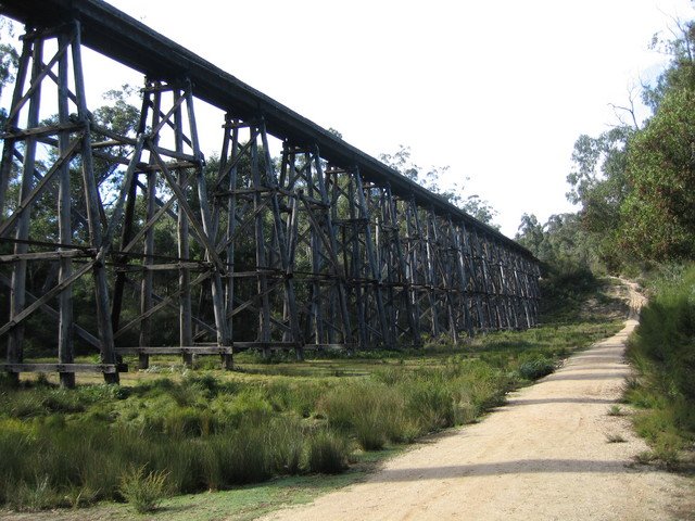
Famous trestle bridge near Nowa Nowa on the East Gippsland Rail Trail. (Image: Adrian Tritschler/flickr)
Bike along some of the country’s most developed rail trails, all within scenic Victoria. With 45 options available, take your pick from short rides through to trails that make for an ideal weekend trip. No matter what your choice, you’re bound to see beautiful landmarks,lookouts, and vast landscapes. Stop at the Lily Street lookout along the 28km Maribyrnong River Trail for a view of the Melbourne skyline along the river, or check out the 18km Bayside Cycling Trail for stops at the historic Timeball Tower and Gem Pier.
For a challenging weekend to remember, give the East Gippsland Rail Trail a try. The 94km trail winds through a variety of forests, farmlands, and three major wooden trestle bridges. This ride also offers scenic views of the Gippsland Lakes. Another favourite among the trails is the 40km Lilydale to Warburton Rail Trail, which runs through the Yarra River Valley and surrounding vineyards and villages. This trail promises gorgeous backdrops of mountains and views into Yarra Ranges National Park.
If you have more than a weekend to spare and want to take on the newest and one of Australia’s longest rail trails, try out the Goulburn River High Country rail trail. With construction set to be complete in December, the 134km completed trail will connect various communities from Tallarook to Mansfield. Biking along the Goulburn River, the scenic Trawool Valley, and past historic landmarks are just a few of the adventures available on the Goulburn River High Country trail.
One of the most iconic trails in Victoria is the 53km Ballarat-Skipton rail trail. Take time to admire the Arch of Victory, a memorial built to honour the people of Ballarat who enlisted in World War I. The arch marks the beginning of the 22km stretch of the Avenue of Honour, adorned with a tree planted for each of the 312 WWI enlistees. Outside of Ballarat, you might recognise Nimmons Bridge as you bike along – it is one of the most photographed sights along the trail. Have lunch at one of the picnic tables near the bridge and admire this giant wood trestle beauty and the surrounding valley. The remainder of the trail winds through historic Linton, rolling farmlands of Pittong, and ends at the picturesque town of Skipton.
Getting there: The rail trails of Victoria have various launching points across the state, so check out a trail map to find out which part of Victoria your chosen trail starts. Access to many of these trailheads can be reached from Melbourne.
When to go: Summer months in Victoria are generally pleasant – maximum temperatures generally hover around the mid- to high 20s- with only a few occasional hot spells. Winter can be bitterly cold, with the highest temperatures barely reaching 10˚C.
Camp: Camping isn’t possible along every trail but you’ll almost always find a site nearby; there are no designated camping areas along the Goulburn River High Country Rail Trail but there are camping sites at caravan parks in Yea, Molesworth, Alexandra, Bonnie Doon and Mansfield. For information on the closest camping sites to each trail as well as descriptions and maps of the trails go to www.railtrails.org.au.
7. Gulf Region, NT
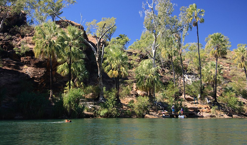
A gem of this region is Lorn Hill Gorge, near the NT/QLD border. (Image: Winam/flickr)
The Gulf Track from Borroloola to Normanton gives the 4X4 enthusiast a chance to encounter some of Australia’s wildest and most remote areas. At first, it appears to be a dry and barren trip, but a few side diversions take travellers to picturesque gorges and rivers.
This route is not complete without driving along the McArthur River, about two hours south of Borroloola. This is a great spot for fishing and canoeing, as the waters of the Gulf produce bounties of barramundi. Crossing the river along Burketown Crossing will take you east along the Savannah Way. A great opportunity for a small side trip presents itself about 50km down Savannah Way; after crossing the Wearyan River, there is small track just 300m down the road that leads to the Wearyan Falls.
One of the Gulf’s must-visit camping spots is Seven Emu Station, owned by Traditional Owner, Frank Shadforth. The station’s river cliff-side campsites are brilliant. Stay for a few days and check out the plethora of birdlife – and try and spot some crocs – as well as Top End station life. Lawn Hill Gorge, located near the NT-QLD border, is another Gulf gem. This will be a reward at the end of your trip; go for a swim surrounded by stunning cliff views.
Getting there: Borroloola is 954km south-east of Darwin and 380km from the Stuart Highway.
When to go: The dry season (April-October) is ideal. During the wet season, the area can be totally inaccessible, as dusty and dry tracks can instantly disappear in water.
Camp: Places to stay in the Gulf region are few and far between. Be prepared to be completely self-reliant. Planning ahead is vital. The area is very remote, and accidentally veering from the track can be easy. Map your route carefully, and keep in mind that this can be a harsh environment.
8. Oxley Wild Rivers NP, NSW
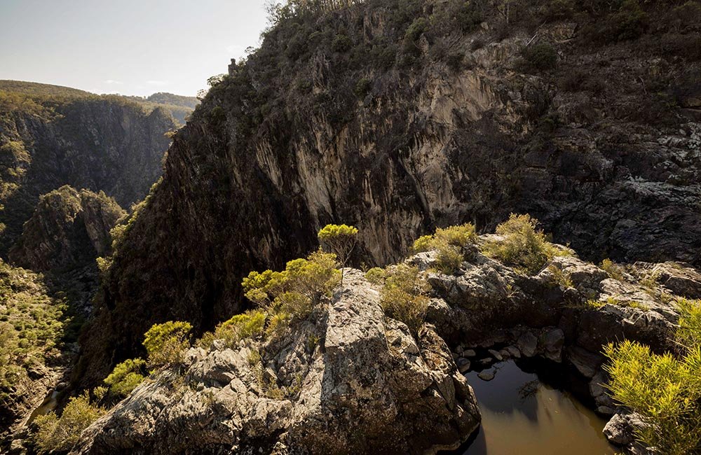
Sailsbury Waters plunges off the escarpment into Dangars Gorge in Oxley Wild Rivers National Park. (Image: Drew Hopper)
Roughly 95KM north-west of Port Macquarie, NSW, the Oxley Wild Rivers National Park offers the chance to take on an extensive 4WD track that passes by beautiful waterfalls, gorges (including the scenic Apsley and Gara gorges), and breathtaking views.
A worthwhile trip is one to Mary’s View, with amazing views. There are two ways of getting there; the first is to travel along Waterfall Way to the Willawarrin village, where you can take Carrai Road all the way to the view. Another is to travel east along the Oxley Highway, through Werrikimba NP, and then to Carrai Road. Both ways take about seven hours return without stops. Roads are often narrow, winding, and can be slippery when wet.
A true treat within Oxley Wild Rivers NP is Wollomombi, the highest waterfall in NSW, standing at 220m. Just 20km off the Oxley Highway,Apsley Gorge is the easiest access to the falls. If you want to stay in the area, accommodation is available in Riverside, Youdales Hut, and the East Kunderand Homestead. Stop at the magnificent Gara Gorge, just 18km south-east of Armidale along Castledoyle Road.
Be sure to strap on your kayak or canoe, as the Macleay River provides some exhilarating opportunities for paddling. Kunderang West, a 4WD-accessible campsite, provides an ideal access point for launching. Take on a day trip to Kunderang East or stretch out your stay for a weekend and paddle down to Georges Junction. The park is not continuous throughout the length of the Macleay River, so request permission from landholders if you plan to camp outside the park.
Getting there: Access is possible from the Hastings Forest Way as well as the Racecourse Trail from Port Macquarie, about a two-hour drive on either course.
When to go: The best times to go are in the spring and autumn, with temperatures averaging 21ºC.
Camp: Fees apply for each campsite ($5-10) as well as daily vehicle fees ($25 for day visits and $40 for overnight). The East Kunderang Homestead is great for groups of up to 14 people. The Halls Peak campground caters to visitors looking for a secluded camping setting. Visit the NSW Environment Department website
READ MORE:


