THE CORAL SEA is serene today. Palm trees cast flickering shadows over a golden beach as a family makes its way across a tidal causeway towards a rocky island, fishing rods and buckets in hand.
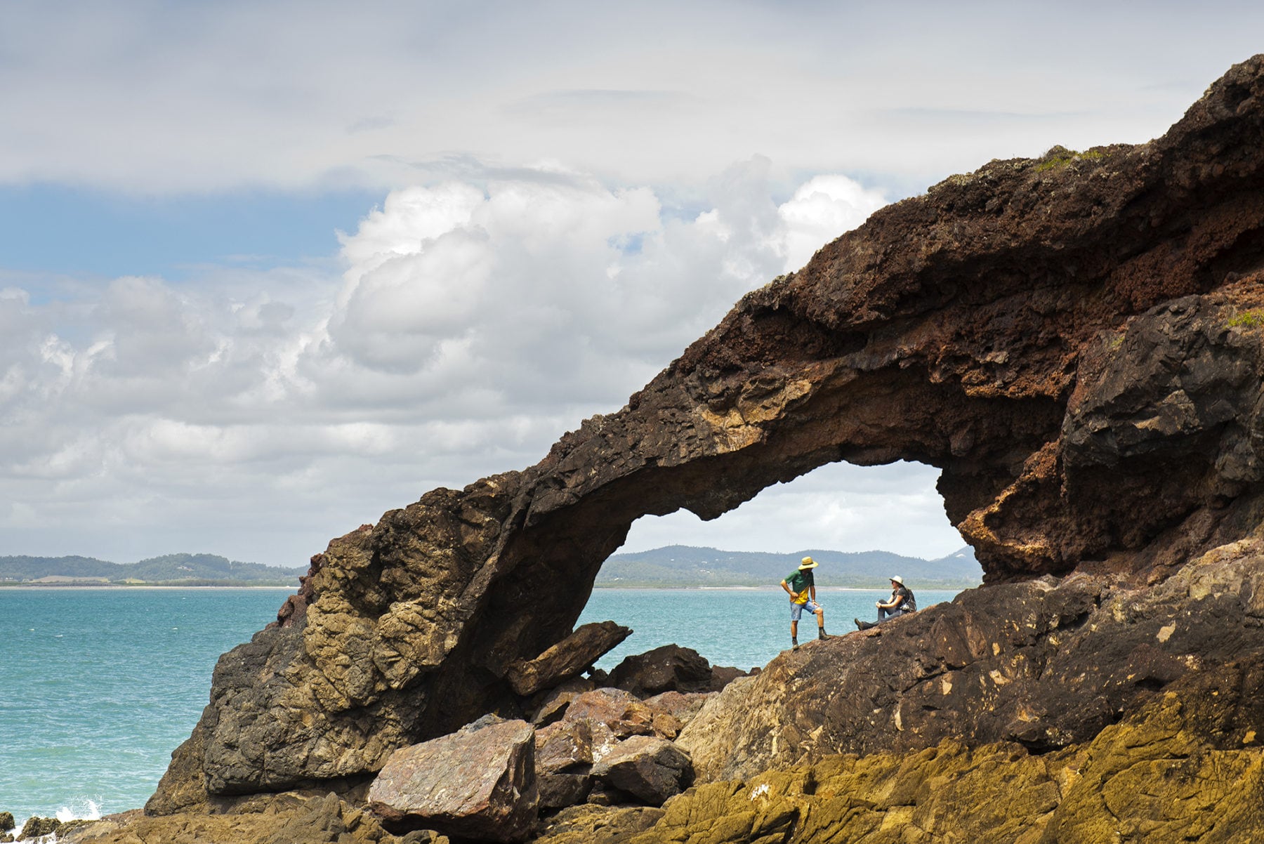
Behind them, on the mainland, hills clad in hoop pine forests roll towards the shore, their green expanse interspersed with occasional bare, jutting outcrops. On the island’s ocean side, sunlight glints off crystals embedded in black and red rocks.
This is Wedge Island, off Cape Hillsborough in Queensland, and the bay here is evidence of an ancient volcano that formed some 34 million years ago.
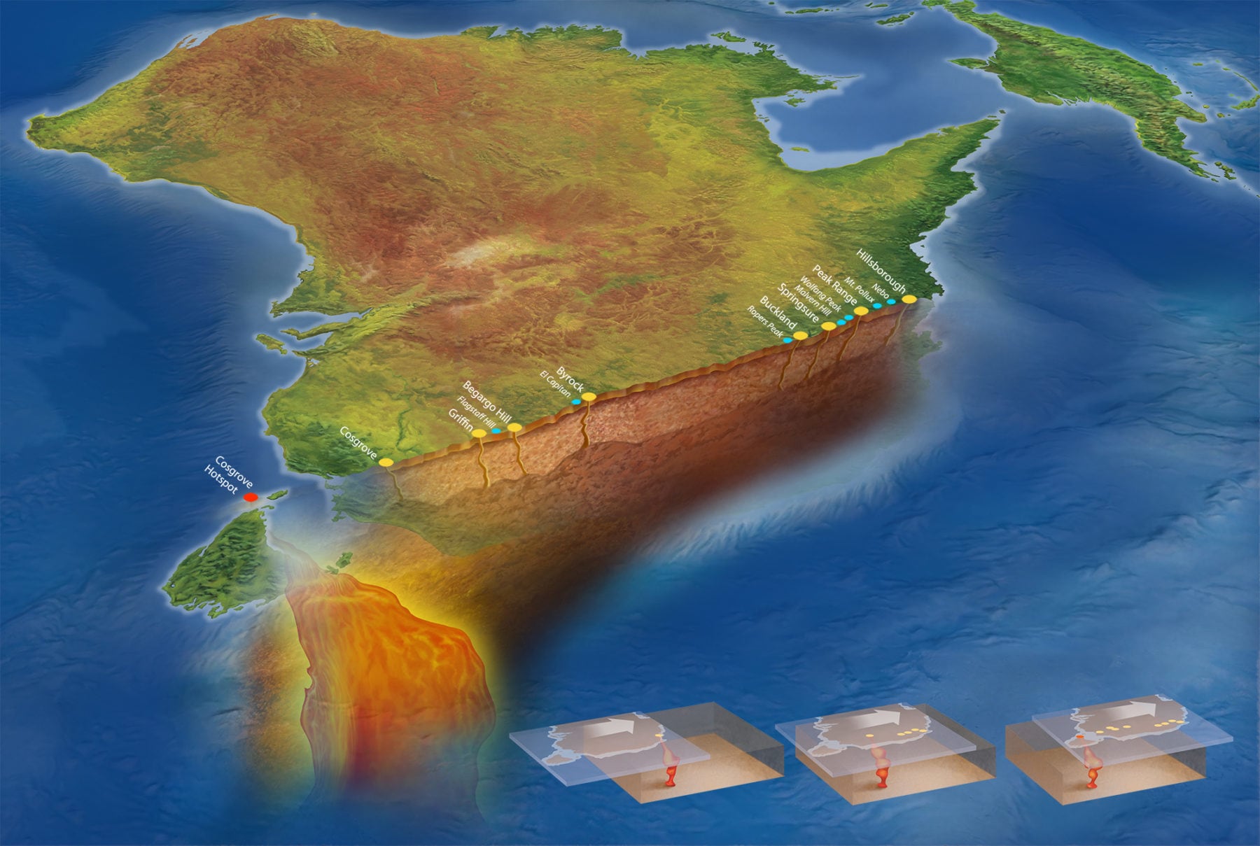
It marks the northernmost point of the Cosgrove hotspot track, a chain of extinct volcanoes that extends southwards across eastern Australia through Queensland, New South Wales and Victoria, to the coast near Melbourne, and is now theorised to be located under Bass Strait near the northern Tasmanian coast. At more than 2000km, it is the world’s longest terrestrial line of intraplate volcanoes.

These types of volcanoes are unusual because they don’t occur at tectonic plate boundaries, where most volcanoes form. Instead, they occur within tectonic plates, forming above hotspots in the Earth’s mantle.
Volcano chains such as the Cosgrove hotspot track form when a tectonic plate moves over a hotspot. The track has puzzled geologists since it was discovered in the 1970s. It formed as the Australian crustal plate drifted north-northeast over a stationary mantle plume hotspot located some 3000km below the Earth’s surface.
Recently, an international team led by Australian scientists has been able to explain why the volcanoes in this chain vary so dramatically in size and composition, and why they occur in certain places but not others.

How did the volcanoes form?
The only constant in any landscape is change. Relentless transformation on a gigantically slow scale is happening around us all the time. Over millennia, giant boulders can wear down to soil, and rocks that were once deeply buried underground can be uplifted to the surface. But with volcanoes, the usual rules don’t apply. Consider Wedge Island, for example. Its oldest rocks are composed of limestone dating back 65–55 million years ago. About 34mya, fiery lava erupted here, enveloping the Earth and leaving behind thick, black, bubbly flows of basalt. Metres of white ash and boulders rained down on top, and thicker, stickier lava, or rhyolite, oozed across what would become Wedge Island. This all happened with dizzying speed, geologically speaking. But once the volcano’s final belches of ash and smoke died away, things slowed. Millennia ticked by with nothing but wind, rain, ice, and thaw to differentiate them. Vegetation grew, retreated, then grew again.
Crystals developed in the basalt bubbles. They formed geodes (spherical, nodule-like rocks with hollow centres coated in crystals) and thunder eggs (round, nodule-like rocks with solid or near-solid centres, usually composed of chalcedony, agate or quartz). The rhyolite weathered and eroded and the layers tip-tilted to form cliffs, creating the landscape we see today.

The Cosgrove track
“I’m the third generation to [farm] this land,” says Kim Smith, who is washing down her horse trailer near her home tucked beneath the towering spire of nearby Pinnacle Peak. The peak is a plug formed by the Cape Hillsborough volcano, and Kim’s horses graze on its green lower slopes. “My grandfather bought this land in 1952; he started with dairy and small crops and then went to sugarcane,” says Kim, who now uses the land for agisting horses. “We have really good soil because of the volcano and grow great grass. Everywhere else dries off but this place stays green. I get my door beaten down [for] agistment.”
Kim’s family has long loved the volcano that looms over the land for more than its agricultural benefits.
“You know how the volcanic rock breaks geometrically?” she asks. “My grandmother had a garden edged with those stones.” That love has been passed down through the generations. “My daughter is eight and wants to be a geologist,” Kim adds. “She loves going to school and saying she owns a volcano!”
The volcanoes along the Cosgrove hotspot track are fascinating to Earth scientists too. “Plate tectonics theory predicts that most earthquakes and volcanoes will occur at plate boundaries,” says Associate Professor Rhodri Davies of the Australian National University’s Research School of Earth Sciences. “But Australia doesn’t sit on a plate boundary. So this is an intraplate volcanic province, and one of the largest continental examples on Earth. [Evidence of volcanic activity] can’t be explained by standard plate tectonic processes – there has to be another mechanism at play.” In this instance, that mechanism is a mantle plume.
“A mantle plume is a hot, buoyant volume of rock that rises all the way from Earth’s core to the surface,” Rhodri explains. “That may be hard to visualise, so I always use the example of a lava lamp where you heat the base. Think of that as Earth’s core, which is significantly hotter than the overlying mantle. It heats up some mantle rock that becomes buoyant enough to rise towards Earth’s surface. Almost 3000km later, it hits the top of the mantle – the base of the lithosphere. Like a lava lamp, you heat the bottom and spawn this buoyant lava that rises and hits the top. That’s how mantle plumes give rise to intraplate volcanoes.”
Mantle plumes are stationary, but the Australian continent moves northwards at about 7cm a year. So, over millions of years as the continent moved over the plume, volcanoes erupted in turn along the line now known as the Cosgrove hotspot track. The plume first hit the Australian continent at Cape Hillsborough about 34mya, and, as the track progressed southwards, more volcanoes formed. Those at the track’s southern end are millions of years younger than those in the north.
“It’s the longest continental track on Earth,” Rhodri says. “The Hawaiian-Emperor track in the Pacific Ocean, for example, is thousands of kilometres long and records volcanism for around 80 million years [but is in the ocean]. The other example on a continent would be Yellowstone, in the USA; that track is about 700km long and records volcanism for about 17 million years. But the Cosgrove track records volcanism for about 35 million years and is just over 2000km long.”
Not only is it the Earth’s longest continental track, it used to be – until recently – the most mysterious. Rhodri was the lead researcher on a paper published in the scientific journal Nature, in 2015, that solved the track’s most baffling conundrum: the volcanoes it created vary dramatically in size and composition. Some are enormous, some are almost unnoticeable, and there’s even a 700km-long gap where there are no volcanoes at all.
Rhodri and his colleagues determined that the explanation for this was to do with the thickness of the lithosphere, the Earth’s rigid outermost layer. “Australia contains some of the largest lithospheric thickness variations on Earth,” he explains. The team noticed that where the track enters northern NSW, a mineral called leucitite was present in the rocks. They deduced that leucitite appeared where the lithosphere was only just thin enough for magma to erupt through it.
“The larger volcanoes occur in regions where the lithosphere is thin,” Rhodri explains, although ‘thin’ is a relative term because here it means less than 130km deep. “And our hypothesis for why that occurs is that the underlying plume is able to rise to shallow depths, melt extensively, produce a lot of magma and a large volcano. The leucitites occur exclusively in regions of intermediate lithospheric thickness. So there we argue that the plume rises to depths where it can only melt to a small degree, and those melts are such low volume that they can only build small, low-volume eruptions.” Where the lithosphere is thicker than 130km, there are no volcanoes at all.
Rockhound
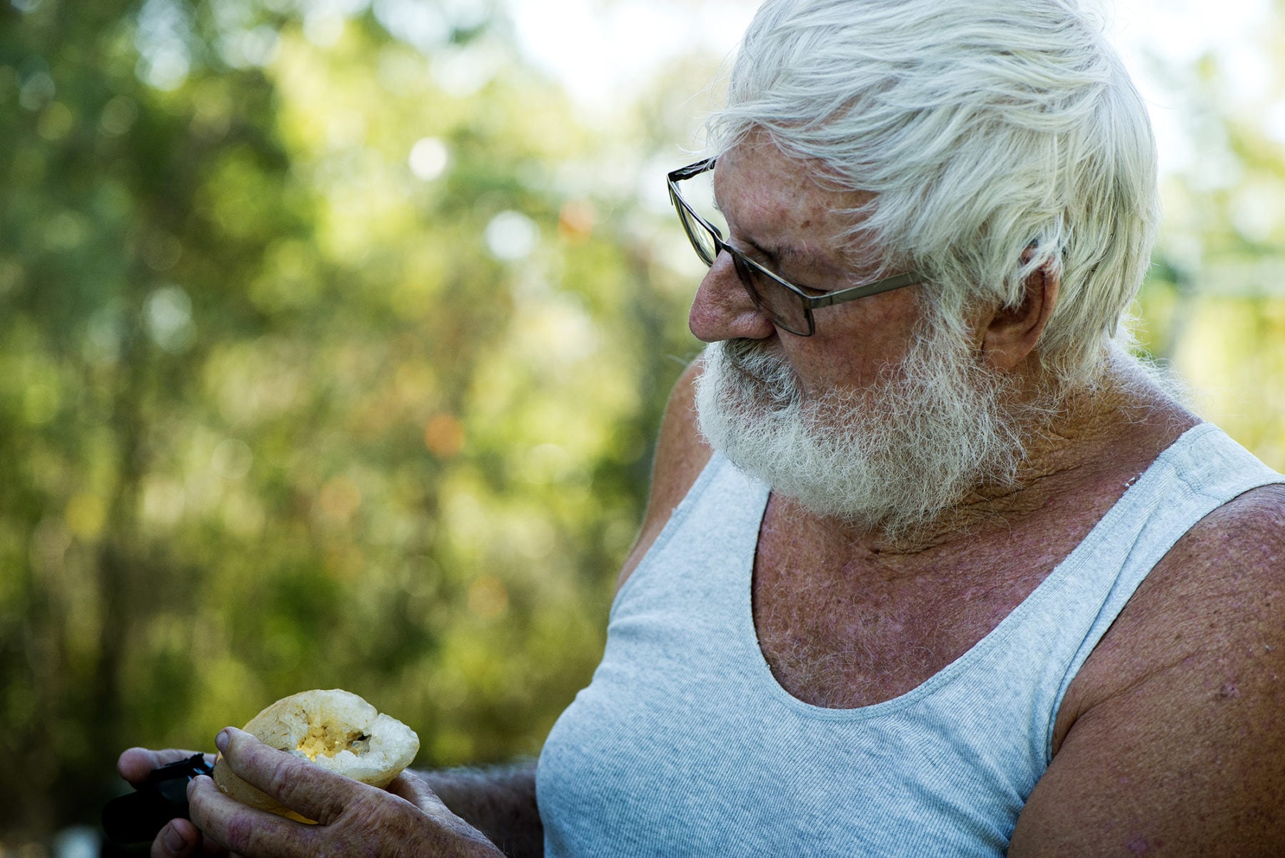
Visit Kevin Smalley at his home near Smalleys Beach (named after his family, who arrived in 1925), at Cape Hillsborough, and you’ll see the results of a lifetime of rock-collecting piled up in the yard on trestle tables, in crates, on windowsills and around the front door.
Kevin is a rockhound. “Ever since I was old enough to crawl on hands and knees I’ve been interested in rocks,” he says. “I’m all self-taught – I’ve never worked in the field.” He’s passionate about the beauty and rarity of the local rocks, and they all come courtesy of the volcano. He displays rock after rock, plenty of which he literally found in his own backyard.
“These are doubly terminated quartz crystals,” Kevin says, brandishing a handful of crystals that do indeed have points on both ends. “The crystal was formed and reheated, so it grew again. They’re from right here, underneath the ground. But they’re pretty rare.” He brings out jasper, quartz, chalcedony, porphyry. “I bet you’ve never seen that before,” he says of a rock he calls Chinese writing stone – pale and flecked with black scribbles like Chinese characters – that’s from a nearby creek.
He passes me an unremarkable rough, grey stone about the size of a football. “Take that into the sun,” he directs, and it comes to life with a million sparkling points of light, like fire from the Earth’s core. “Perlite,” he says.
Kevin’s love of rocks stems in part from awe at nature’s intricate, artistic craftsmanship. “The quartz crystals are my favourite,” he says. “It amazes people to look at these perfectly formed crystals in the rock and know jolly well that nobody cut ’em and put ’em there. That’s just how they are. No-one did it.” The glimmering jewel in the crown of his local collection is a radiant geode. “That’s what you’re here for,” he deduces, smiling.
He expects his passion for rocks to outlast even his own lifetime: “When I do die, and I don’t want to be there when it happens, I want my tombstone to say: gone prospecting.”

Fertile land
By about 32MYA, the continent had moved northwards by about 350km. Because the plume is fixed, new volcanoes were created south-southwest of Cape Hillsborough in what’s now called the Peak Range volcanic region. “I’m glad I wasn’t here when they were spewing out,” says Dave Pitt, gesturing towards the volcanic peaks studding his land. He’s lived on Gaylong Station, near Dysart in Queensland, for more than 40 years. The Peak Range, which runs through the property, is part of the Cosgrove hotspot track. “It’s extremely fertile country; the cattle are in really good order,” he says, explaining that is because of the minerals in local rock.
That rock is basalt, which creates excellent soil, explains Central Queensland University geoscientist Dr Andrew Hammond. “Basalt is the cradle of human civilisation,” he says, adding that soils are simply broken-down rocks, and basalt soils are particularly fertile. “They’ve got lots of nutrients: magnesium, calcium, iron and other goodies that plants love. The soil creates areas animals go to because that’s where the food is – the pasture. Think of the African rift valleys.” Animals flocked there and people followed, finding it was very fertile, making it suitable for agriculture. The rift valleys formed via a different geological mechanism from the Cosgrove hotspot track, but the resulting rich basalt rock is the same.
Dave certainly loves his fertile land. “It’s pretty when it’s green,” he says, gesturing behind him towards Gilberts Dome. “Leichhardt said this was the most impressive peak of all but I tell you what, Scott and Roper are so impressive.”
Dave is talking of explorer Ludwig Leichhardt, the first European to travel here, in 1845. He described the “noble peaks” and “fine ranges”, writing that “a succession of almost isolated, gigantic, conical and dome topped mountains…spread before our delighted eyes”.
Gilberts Dome is impressive, but when driving along the Peak Downs Highway, it’s Wolfang Peak that catches the eye. Like Dave’s volcanic spires, it’s part of the Peak Range. Towering a majestic 572m above the flat surrounding agricultural land, it’s a rhyolite plug once encased in basalt that’s long since eroded away.
Look closely and you’ll see what look like steps near the top. “They’re known as columnar joints,” Andrew says. “Nature loves to make patterns and polygons.” The bold can venture over a barbed-wire fence and climb the fang-like peak to explore these columns, but beware: there are no paths to follow. Nor are there tracks to nearby mountains Castor and Pollux, named for the twin brothers of Greek mythology.
More rounded than Wolfang Peak, Castor and Pollux are also rhyolite. “Basalt flows like a river; it goes to the lowest point and solidifies,” Andrew explains. “But when you see basalt flows high on top of landscapes, that’s because basalt is a harder layer. Other structures around it disappear [through erosion] because they’re softer, and it gets left up as a pedestal in the landscape. That’s an inverted landscape: what was on the bottom is now on top. Rhyolite doesn’t flow as far as basalt; it’s thicker, stickier and not as hot.” That means it creates more rounded forms, such as Castor and Pollux.
Nearby Lords Table Mountain is different again – a trachyte plateau more than 300m high lying on top of basalt. Trachyte is another volcanic rock, richer in potassium feldspar than basalt but with less quartz than rhyolite. Climbing up to the saddle – another track-free endeavour – provides glorious views of the surrounding farmland taking advantage of this rich volcanic soil.
Stop along one of the region’s many back roads and take a walk near one of these dramatic peaks, and you can hold ancient history in your hand. “These are about 30 million years old,” Andrew says casually, examining a couple of stones. “There’s pitchstone out here – that’s volcanic glass. Some of these are chalcedony.” He walks further from the road to a spot in the grass that looks to be identical to any other. “There’s lots of crystallisation happening in this tiny little area – look!” He holds out a geode, broken open by time and lined with tiny pink quartz crystals.
One to 4 million years after the Peak Range eruptions, more volcanoes formed and erupted further south. These are 30–28 million years old and now part of Minerva Hills National Park. During the few million years between the Peak Range and Minerva Hills eruptions, the continent moved by nearly 200km.
It’s a steep drive up an unsealed road to reach the cliff tops and pinnacles overlooking the town of Springsure. The Springsure volcano is responsible for these striking formations, and along the scenic drive inside the park, the layers of its eruption are visible in the road cutting, with beds of sediment, conglomerate and ash rising metres above the road surface. The landscape speaks its history to those who know how to listen.
Trachytes create poor soil, so there’s little vegetation up here. The Skyline Lookout Walk winds through spinifex and bare rock and emerges to offer views of Virgin Rock, a separate plug long eroded away from the rest of the plateau. It’s calming up here above the town, the agriculture, and the business of everyday life, but it’s a calm that belies the chaotic nature of this landscape’s formation.

The Cosgrove hotspot track holds more discoveries
Far from Minerva Hills’ poor soils, almost 2000km south, is the site of Cosgrove, for which the track was named. Located near Victoria’s Goulburn Valley, it’s covered with orchards of fruit trees trained into V-shapes for robotic picking. An old sign for Cosgrove stands beside the road, but there’s nothing there but a tumbledown house with a yard of rusting cars. The brown metal sign on a stone cairn points to a historical monument explaining this bare earth was a church in 1899. The only sound is from bees buzzing in the flowers of false pepper trees. The biggest thing at Cosgrove now is the quarry. “Basalt is a wonderful rock for making aggregate, and to put a decent road in, you need aggregate,” Andrew explains. “So it’s a huge natural resource.”
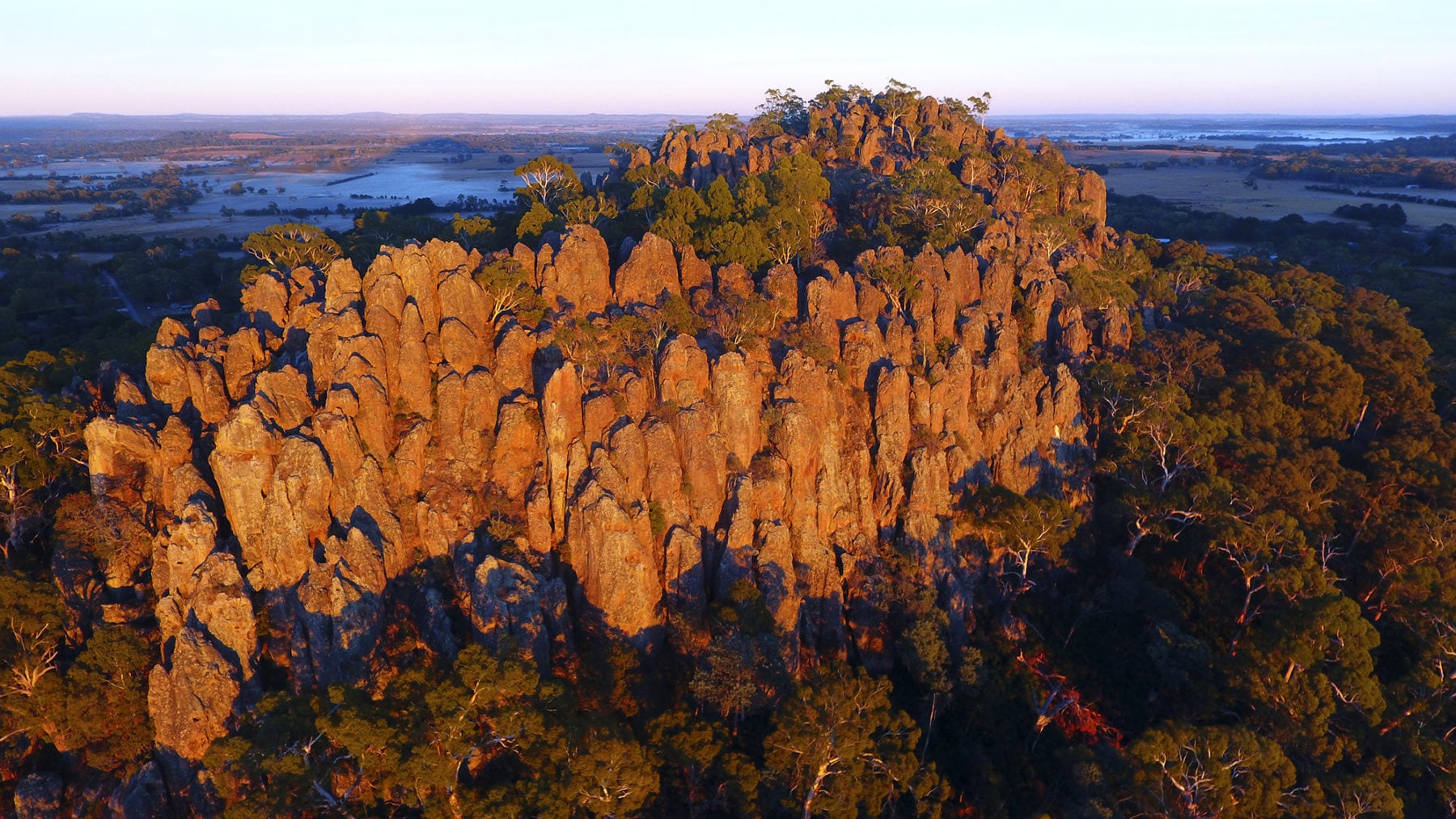
There are no quarries, but plenty of fertile earth, in Mount Macedon, south-west of Cosgrove, where lush, well-tended gardens surround out-of-sight mansions lining the road to the peak. Garden walls are made of stacked lava boulders because, of course, this rich soil also comes courtesy of a volcano. The plume is thought to have ignited a volcano here 6 million years ago, with Camels Hump and Mount Macedon being parts of its remains. The path to Camels Hump winds for a kilometre from the car park up to the summit. Jagged tumbles of rock with plenty of ridges and pits are a rock-climber’s paradise. Hanging Rock, whose eerie atmosphere is central to the famous novel and film, is visible below in a cloak of trees, unassuming from this height, but dark in the landscape.
Hanging Rock itself may also be related to the track. Like Mount Macedon it’s 6 million years old and it’s possible the heat of the nearby plume melted rock that oozed up through a vent as thick lava, in a formation called a mamelon. Rhodri Davies suggests the whole Newer Volcanics Province (see AG 137) in western Victoria may be related to the plume in a similar fashion.
Today, the mantle plume responsible for the volcanoes along the Cosgrove hotspot track still exists. “The plume should be off the west coast of Tasmania now,” Rhodri says. “In theory, we should expect some record in the Bass Strait.” This means the Cosgrove hotspot track holds more discoveries, and Rhodri is excited to be working on it in the unique environment of Australia’s ancient rocks. “We can only examine how a plume interacts with such large variations in lithospheric thickness on the Australian continent,” he says. “And that’s really how we’re going to unravel much more of Earth’s history as we move back in time.”


