Walking the Southern Cape, Tasmania

YOU KNOW IT’S quiet when the loudest sound you hear is a whale breathing. We’re less than a five-minute walk from the white sand of Fortescue Bay in Tasman National Park, about 55km south-east of Hobart. This is the midpoint of the Tasman Coastal Trail and the park’s hub for day walks, camping and boat fishing.
Although the weekend weather is bright, we’re alone here. That’s if you don’t count the 14m-or-so southern right whale and her calf, itself the size of a small car, circling in the bay near our lichen-daubed vantage point. This section of track heads east past campsites at Bivouac Bay, then north over 571m Tatnells Hill to Waterfall Bay. Tasmanian blue gums stretch their crescent-leafed branches overhead and drooping she-oak branchlets glisten with water drops, the legacy of an overnight shower.
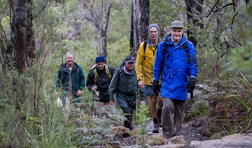
Only 100km by road from Hobart, the Cape Hauy Track is a day walk on the Coastal Trail, and it is be part of the Three Capes Track. Many Hobart-based walkers tackle the Coastal Trail in stages, as time and weather permit. Bushwalking mates (from right) Shane Hogue, Tim Respondek and John Kelly head back to Fortescue Bay from Cape Hauy.
But we’re riveted by the mammals lolling in the bay. For two hours their distinctive V-shaped blows steam in the morning air. The juvenile is a livewire, rolling around, grumbling and occasionally taking a feed. Mum’s mostly pretty calm and still, although she plays with her calf for 10 minutes, rolling to expose her 1.8m pectoral fins and then diving again, tail flukes up.
The experience is extraordinary for us but it’s a standard morning on the Tasman Coastal Trail. Just an hour or so from one of Australia’s state capitals, we feel a million miles from care.
“Tasman National Park’s probably got the most spectacular coastline of any park in Tasmania,” says Luke Gadd, one of two Tasmania Parks & Wildlife Service (PWS) rangers stationed here. “There’s a high biological diversity, as well, and a high number of recreational opportunities – and we’ve got some of the best day walks in Tasmania.”
The Coastal Trail was built in stages over many years with the help of Hobart Walking Club (HWC). It was officially recognised in 1998 and combines several day walks and additional track into a coast-hugging 53km trek, typically requiring 4–5 days to complete. Today we’ve joined Luke on the track’s northern section – the 1.7km amble around Waterfall Bay to Waterfall Bluff – an easy stretch that provides a first taste of the track’s high cliffs.
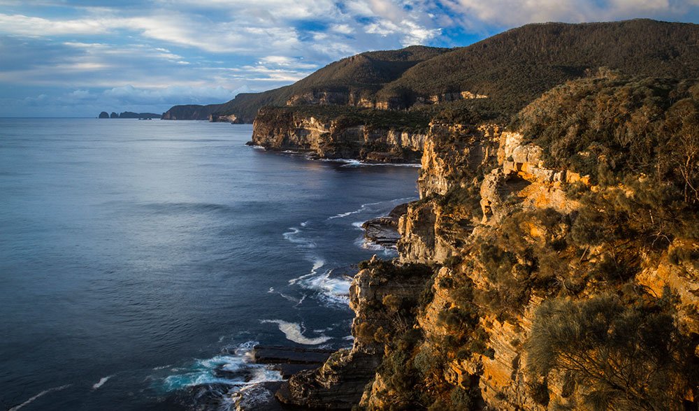
Tasman National Park’s east coast boasts tall cliffs and wave-washed bays. In the distance, Cape Hauy and The Lanterns are key waymarks on the 53km Tasman Coastal Trail.
The sedimentary sea cliffs in this part of the park rise to an impressive 150m above the waves, Luke tells us. “And where the ocean meets the cliff, you get a whole range of features – wave-cut platforms, arches, blowholes and sea caves.” But the cliffs here are nothing compared with the dolerite drop-offs in the southern portion of the park, at Cape Hauy [pronounced “hoy”], Tasman Island and especially at Cape Pillar, which Luke says sports “some of the tallest vertical sea cliffs in Australia, if not the Southern Hemisphere”.
Dolerite – the ‘rock of Tassie’ – covers about two-thirds of the island. Originating as lava about 180 million years ago, it cooled under the Earth’s surface into columns, which are now exposed, and tend to weather vertically, thus explaining the sheer drops.
Differences in underlying geology and some particular traits of the climate – notably fierce southerly winds – have created a diverse range of habitats in the park, from patches of rainforest to buttongrass plains, coastal heath and tall eucalypt forests.
The park was proclaimed in 1999, a patchwork of previously logged former state forestry and reserve lands, but unusual species remain. They include three species of the flowering herb called eyebright, found only in this area, the distinctive heath plant Epacris marginata, and the wonderfully adaptable Cape Pillar she-oak.
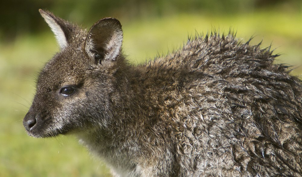
Tasmanian pademelons do well in the park’s relatively isolated habitats and feed at dusk and dawn beside the tracks.
A small permanent human population of fewer than 2000 people, and the isolation caused by a single access to the peninsula by land (the narrow isthmus of Eaglehawk Neck), have encouraged strong numbers among mammals. These include pademelons, bettongs and Bennett’s wallabies; wombats, three possum species, quolls and Tasmanian devils. Echidnas are often seen during early summer and the smaller mammals include long-tailed mice, swamp rats and dusky and swamp antechinus.
“We’ve just heard some interesting news about the dusky antechinus on Tasman Peninsula,” Luke says. “There’s a genetic study being done and it appears that it might be a separate species.”
The park’s wildlife and other attributes have lately been an important consideration for Luke and his PWS colleagues, as they contemplate imminent changes. Three Capes Track, which is currently under construction in Tasman NP, is scheduled to open in late 2015* and it’s expected to attract up to 10,000 walkers a year, far more than the few thousand who currently walk the trail end to end.
Cape Raoul is on the western coast of Tasman NP and is accessible via the Three Capes Track.
Current trail maintenance is also a low-key affair – upkeep amounts to on-foot inspections once or twice a year, “with a chainsaw and a mattock, just to clear out drains along the way”, Luke says.
As if to prove the point, on the way to Waterfall Bluff he shifts a few wind-dropped branches off the track. At a lookout point, he wrestles with a large fallen limb just a few steps from the cliff’s edge, where he’d rather people weren’t tripping; he has to give up in the end – we’ve set out without a chainsaw.
“The easy parts of the Coastal Trail cater for those who wouldn’t ordinarily go on a dirty-footed walk,” Luke says. “The new track will hopefully provide an interesting opportunity for those who wouldn’t ordinarily do an overnight walk.”
The first section of the Three Capes Track to be finished was a 4.7km section linking Fortescue Bay and Cape Hauy, which was completed in June 2012. Buoyed by our whale encounter, we set out on it along bush-stone steps akin to those you’d find in a fancy suburban garden. Further along, benched gravel and raised duckboards keep our boots mud-free – not a luxury you’d have enjoyed here several years ago.

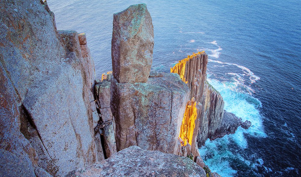
Dolerite drama; The Candlestick, captured from the western side of Cape Hauy.
“Wide and dry, isn’t it?” says David Ferris, one of the Osmiridium walkers, a mates’ bushwalking group, who are exploring the peninsula. The group agrees, with a mixture of pleasure and regret, that it’s not like the old days, when some bush-bashing was required and a pair of gaiters recommended. “Better for the bush though,” says walker Tim Respondek, and it’s been a great day out for the group. His mate John Kelly sums up: “It’s raw, it’s accessible, it’s coastal – and it’s spectacular.”
That it is. In a dense grove of silver banksia, or honeysuckle, New Holland honeyeaters perch at high points, while crescent honeyeaters make their distinctive “idjit” call, and thornbills, wrens and finches circle the trees. All around the banksia buffet is evidence that yellow-tailed black cockatoos have devoured a meal.
The track might be new but the dizzying views out at the cape, to the north and east of Mitre Rock, The Lanterns and The Candlestick, and down at rock climbers’ favourite – the Totem Pole – are unchanged. Those with vertigo be warned: from the narrow path along the sheer cliffs, the safest way to get a view is to lie flat on your belly and peer over. It’s a narrow, finger- and toe-tingling vista; passing boats give a sense of how far it is down to the sea.
The peninsula’s famous cliffs are almost more impressive from the bottom looking up. On a crisp, late-autumn morning, Tasman Island Cruises skipper Ben Connor welcomes us aboard near Port Arthur with the practised ease of a ringmaster. Ben’s worked the coastline since deckhanding for his uncle on a birdwatching voyage out to Cheverton Rock in 2008.
He realised then how special this coast is and he’s explored it by sea and by land over the years since. He’s currently building a home on the peninsula and says “a little passion can take you a long way”.
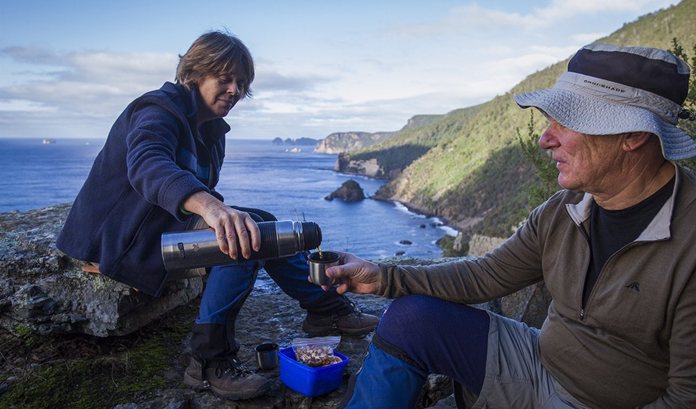
Hobart Walking Club members Trish Colles and Malcolm Sherlock take morning tea at Waterfall Bluff. They’re on a day walk from Waterfall Bay to the lookout on Tatnells Hill.
We cross into open ocean near Budget Head, in the shadow of Arthurs Peak, tracking along the “black shore” – the south-facing dolerite cliffs, which are renowned for their exposure to gale-force winds. Now, with the sun on its cool-season, northerly track, the cliffs are in shadow, mottled by lichen, thrusting upwards. “We get comments about things being man-made but…this is just nature; this is just awesome,” says deckhand Yani Armbruster.
Wave-washed cliff-base rubble is a riot of colour and intertidal life, as University of Tasmania marine science research fellow Neville Barrett points out. “The offshore upwelling brings nutrient-rich Southern Ocean waters and there’s more current and more invertebrate life,” he says. “It’s a real hotspot for marine endemism in south-eastern Australia.”
Fabulous sea creatures seen here include salps and giant pyrosomes, which are both jellyfish-like invertebrates that belong to the group known as tunicates. “The continental shelf is only 7–8km away and they tend to be washed up against the cliffs by the currents, but not smashed, because of the deep water,” Neville says. “There were so many salps earlier this year you could almost walk on the water.”
The area doesn’t get the fish species diversity of tropical waters but the fish here are often found in great numbers – which is good news for piscivorous species. “In February and March we get a lot of bait fish active,” Yani says. “So lots of albatross and a lot of feeding frenzies. It’s just unreal sitting in the middle of hundreds of albatross, watching them grab fish.”
We lap Tasman Island – where Sydney–Hobart race yachts famously turn to starboard and head for the finish line – and pay our respects to the resident fur seals, which slide into the water and gambol around the boat to check us out.
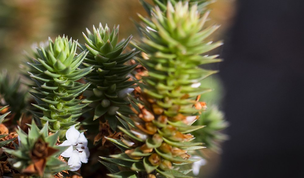
This Epacris shrub grows only on the Tasman Peninsula.
Afterwards, Ben stops at the base of the Cape Pillar chasm, and we gaze uncomprehendingly at sheer dolerite that extends up for about 260m – nearly twice the height of the Sydney Harbour Bridge arch. At the top is Chasm Lookout, which is so far up we’d have trouble making out any people peering down.
More people can see Cape Pillar’s rock spires on a boat trip but the chance to see it at the cliff top – a glorious, isolated, windswept end-of-the-Earth spot – is the privilege of multi-day walkers.
They trek here from Fortescue Bay the longer, harder way – via Cape Hauy and the 490m summit of Mt Fortescue – or they take the short cut, on the mostly flat Cape Pillar Track, which travels inland through an impressively diverse range of Tasmania’s spiky shrubs, including bearded heath, prickly moses and dagger needlebush.
Near the junction of these tracks, the Coastal Trail is a mix of old, new and under-construction sections as it undergoes its Three Capes transformation. We turn off the old track before the descent to Lunchtime Creek and follow a scrub-cut alignment liberally decorated with helicopter-dropped 800kg bags of gravel and loads of duckboard timber, before pitching camp in an area earmarked for a Three Capes hut site.
East of here, the old and new tracks sometimes run two different courses out to Cape Pillar. One contentious section bypasses two of the old track’s most famous places, Hurricane Heath and Perdition Ponds. At Hurricane Heath, scouring winds that have literally blown walkers off their feet have transformed normally 2m-high plant species into ground-huggers. Cairns mark the route across what resembles a Japanese garden, replete with bonsai, to the Ponds, the old track’s easternmost campsite.
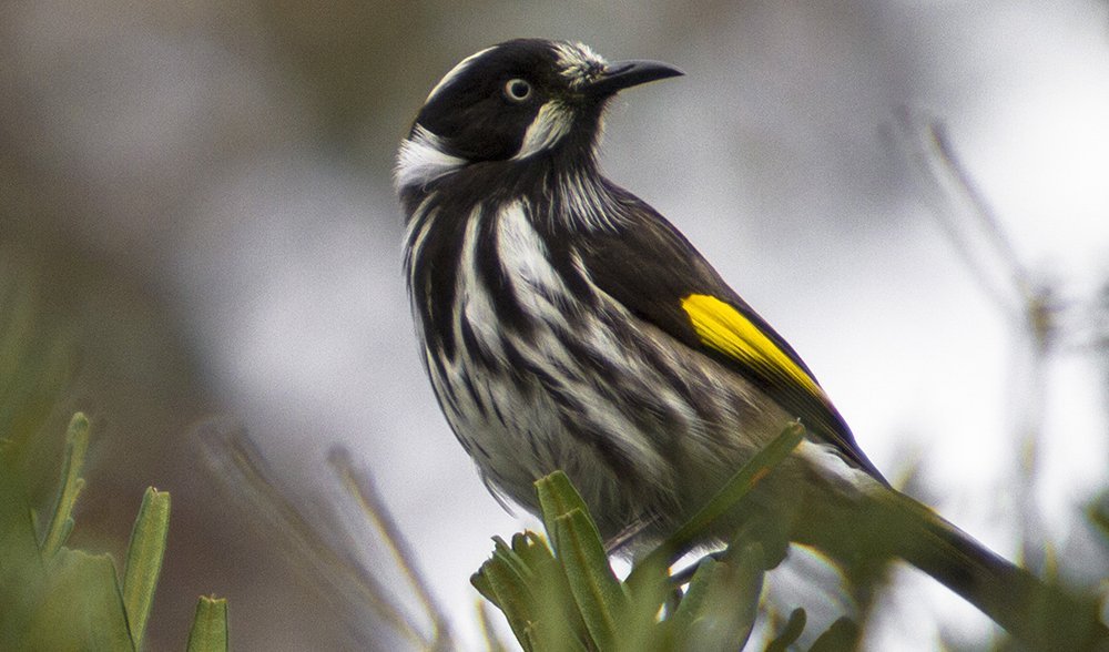
A New Holland honeyeater.
The further east you tread the more isolated it feels; the heath hums with birdlife and the twisting path affords a symphony of views north to Cape Hauy and south to Tasman Island. The crescendo comes at Chasm Lookout and The Blade, from which, improbably, one looks down at Tasman Island’s 200m-high cliffs.
Walking back to Fortescue Bay the next day, we’re more conscious of Three Capes signs. Tag tapes mark the helicopter drop zones; garden stakes number the sections; diamond tags label zones around which the path must detour to protect endemic flora and create buffer zones for the carefully monitored wedge-tailed and white-bellied eagle nests.
It’s a mammoth job, says Simon Wyatt, one of the owners of track construction company Mountain Trails, when we meet him and his crew near Bare Knoll. They’ve been out here on the 3.98km Separable Portion 5 (SP5) for several months already, with work due to be completed within the year. All the signs point to serious effort – there are track-width excavators, piles of rocks, power carriers and hand tools of all kinds.
The supply helicopter chatters overhead, dropping in gravel and timber on four-minute turnarounds from the Fortescue Bay base. It’s hard work, but the crew agrees that it has rewards. “I like the bush and hate town,” says Simon. Joel Hodson sums it up: “Living and working in this scenery is unbeatable.”
SP5 carries around Tornado Ridge to rejoin the inland route to Fortescue Bay. Until now, there’s been no track to the west from here where the coast curls around to Surveyors Cove, on Port Arthur. Now, among the forest and peaks, the Three Capes Track is appearing.
Some of the new track is still a canvas to be imagined, guided by tape markers – blue for track, orange for huts, yellow for helicopter drop zone – attached to plants arching over a flattened survey line that’s barely more than a lick and a promise. But although the section of track joining Surveyors Cove to the Mt Fortescue junction via Arthurs Peak isn’t due to open for more than a year, parts are complete, with glinting stone stairs and duckboards with non-slip chook wire too new to have dulled.
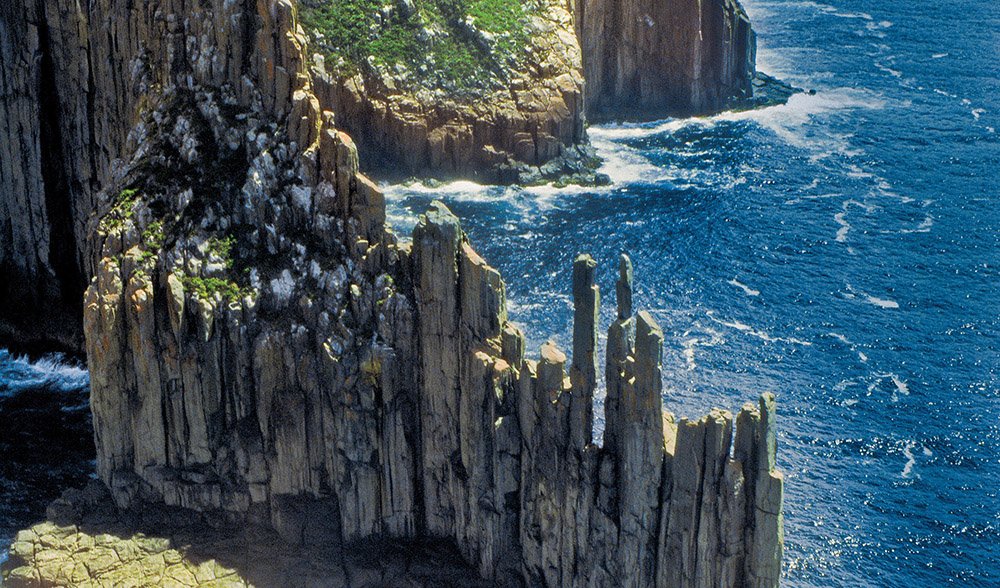
Aerial shot of The Southern Cape.
Actually, the idea for the Three Capes Track is nearly 10 years old in Stuart Lennox’s book. Stuart is PWS’s Director of Visitor Services, but worked at Tourism Tasmania when former state premier Paul Lennon walked New Zealand’s Milford Track and returned enthusiastic about creating a similar experience in Tasmania.
“So I said, rather than us all just throwing a dart at the map, why don’t we try to understand what people are looking for?” Stuart says. “We were interested in the things that make something iconic. Why is the Milford iconic? Why has the Overland become iconic?”
Climbing to Arthurs Peak, Stuart reflects on the long process of surveying and research that brought them here.
“There were so many things…one being that it’s an hour from Hobart airport,” he says. “But that’s not the only one: in terms of building an iconic experience this met more of the criteria than anywhere else.
“If you’re going to put a walk in for lots of people, the landscape needs to be robust. And there’s nowhere else you can get a view like this.”
As we stand on the peak catching our breath, trying to take in a horizon that seems to curve with the Earth, another southern right whale surfaces 300m below. It spouts, then slides like a splash of silver beneath the water and resumes its journey north along the timeworn Tasman coast.
The essentials
Track details
The 53km Tasman Coastal Trail extends from Waterfall Bay to Cape Pillar, intersecting the inland Cape Pillar Track near Fortescue Bay and north of Bare Knoll, where they become one. Reconstruction of the section between Cape Hauy and Fortescue Bay was completed in 2012. This section will form part of the new Three Capes Track*; work is currently being done on the section south of Cape Hauy and down to Cape Pillar. The third section of the track will be entirely new, from Denman’s Cove south along the western coast, to join the Cape Pillar Track near Bare Knoll.
When to go
Most Tasman walkers are attracted to the long daylight hours and warmer weather of November–April. Winter overnight temperatures rarely drop below 4–5°C, but June–October has the highest annual average rainfall.
Getting there
Virgin, Qantas and Jetstar offer regular direct flights to Hobart from Sydney and Melbourne; Virgin and Jetstar also fly direct from Brisbane. Fortescue Bay is about 85km by road from Hobart airport and 100km from central Hobart. Tassielink runs daily bus services to and from the Tasman Peninsula (Port Arthur) during the school term.
Where to stay
Bush campsites along the Coastal Trail are free if you have a park pass (see below). At the Fortescue Bay PWS camping ground, tent sites are $13-plus a night (depending on number of campers) and bookings are advisable at busy times (tel: 03 6250 2433 or email: [email protected]). Elsewhere on the Tasman Peninsula there are commercial camping and caravan parks, hotels, motels, B&Bs and holiday cottages.
Walker notes
A valid park entry pass is required for the Tasman Coastal Trail and popular Tasman NP day walks such as Cape Hauy, Cape Raoul and Shipstern Bluff; 8-week Holiday ($60) or Backpacker ($30) passes are the best value. Use the logbooks provided when you set out and return from your walk. Check with rangers about availability of water as streams can run dry in midsummer.
In the future, a booking and fee system will apply for Three Capes Track walkers (but bookings for Tasman NP day walks will not be required).
Stretching along the Tasman Peninsula for up to 82km, the track will lead walkers to picturesque Cape Raoul, Cape Pillar and Cape Hauy.
Three Capes Track
Tasmania Parks & Wildlife Service hopes the Three Capes Track (3CT) will be seen as the coastal equivalent of the iconic Overland Track. The aim is to create an “achievable walking experience” for people of all ages and abilities and PWS is having a red-hot go at it.
With a budget of about $25 million for its first (eastern) part, the 3CT will feature 90cm-wide paths of gravel, rock and timber. Up to 60 people a day are expected during the October–May peak season and they’ll book online and pay a fee (still to be determined; the Overland fee is $200 for 2014–15). It will be Australia’s only hut-based walk where the huts have mattresses and cooking facilities; walkers won’t have to carry tents, sleeping mats or stoves. A guided commercial walk will use private huts.
Buildings for accommodation, cooking and eating plus PWS staff quarters will be linked by decks or walkways. A prototype hut was installed at Lunchtime Creek this winter. “One of the design parameters was to try and produce something that’s simple and elegant,” says PWS hut project manager Andrew Wagg.
Designed to blend in with the environment and to be durable, the huts will be steel framed and finished with Colorbond steel, fire-resistant blackbutt timber and cement sheets. Their outward-sloping windows are to reduce the risk of bird strike.
* This article was originally published in the September-October 2014 edition of Australian Geographic. Construction of the Three Capes Track has since been completed and is ready for visitors.
Visit threecapestrack.com.au for more information.
READ MORE:
- Tasmania’s veiled beauty
- Fabulous Freycinet Peninsula, Tasmania
- Wildlife wonderland on the Great Ocean Walk


